MyTopo
Olmitz Iowa US Topo Map
Couldn't load pickup availability
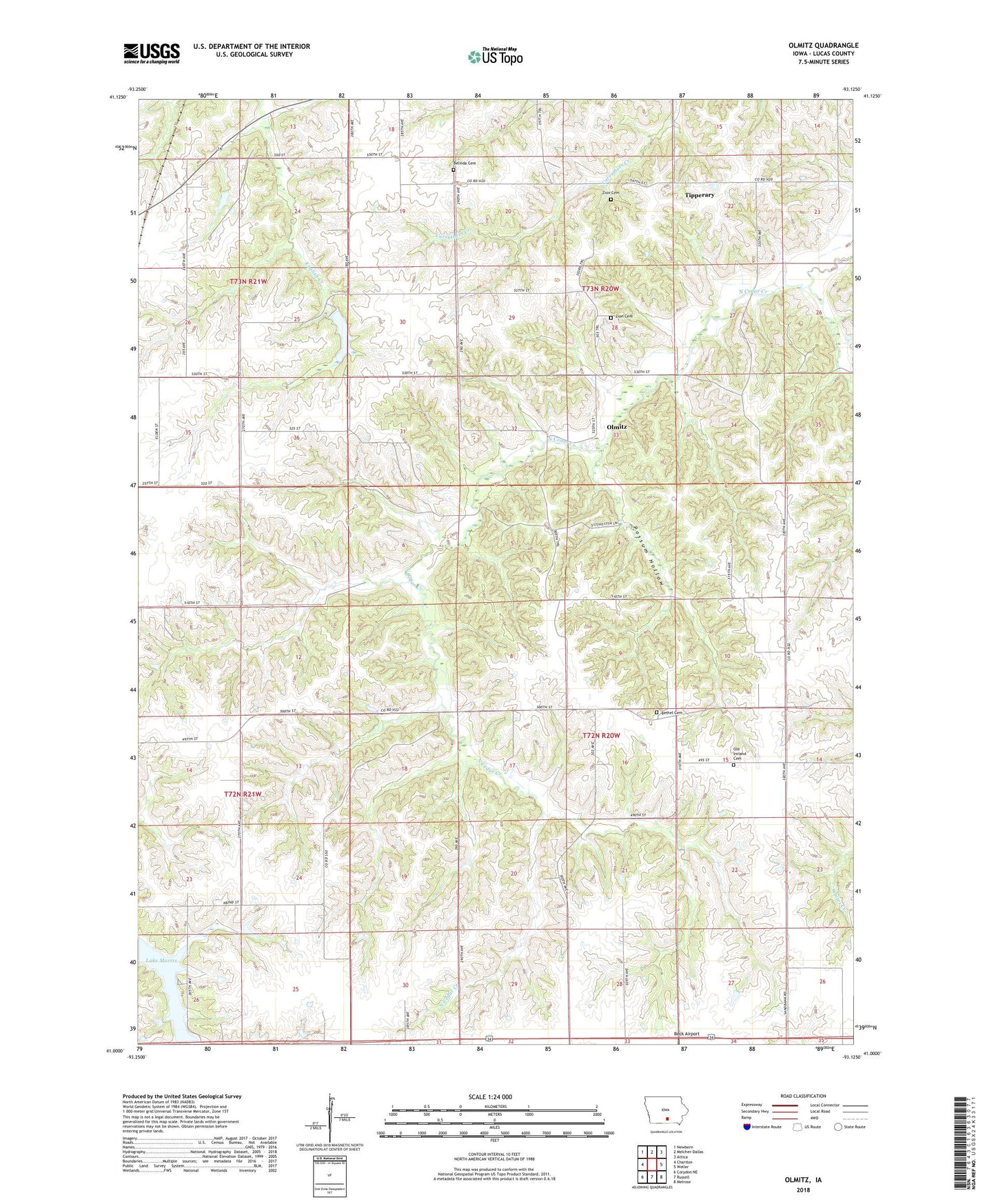
2022 topographic map quadrangle Olmitz in the state of Iowa. Scale: 1:24000. Based on the newly updated USGS 7.5' US Topo map series, this map is in the following counties: Lucas. The map contains contour data, water features, and other items you are used to seeing on USGS maps, but also has updated roads and other features. This is the next generation of topographic maps. Printed on high-quality waterproof paper with UV fade-resistant inks.
Quads adjacent to this one:
West: Chariton
Northwest: Newbern
North: Melcher-Dallas
Northeast: Attica
East: Weller
Southeast: Melrose
South: Russell
Southwest: Corydon NE
This map covers the same area as the classic USGS quad with code o41093a2.
Contains the following named places: Beck Airport, Belinda Cemetery, Belinda School, Bethel Cemetery, Bethel Church, Cedar Grove Post Office, Cedar Grove School, Centennial School, Center School, Coal Glen Church, Franklin School, Highland School, Irish Grove Post Office, Maceville Post Office, Ola Post Office, Old Ireland Cemetery, Olmitz, Olmitz Post Office, Oxford School, Pleasant Townhall, Possum Hollow, Prairie Hill School, Stephens State Forest - Cedar Creek Unit, Stephens State Forest - Chariton Unit, Sunnyside School, Tipperary, Tipperary Post Office, Township of Cedar, Township of Pleasant, Victory School, West Alexander Post Office, Williamson Pond State Public Hunting and Recreation Area, Zion Cemetery, Zion School