MyTopo
Melrose Iowa US Topo Map
Couldn't load pickup availability
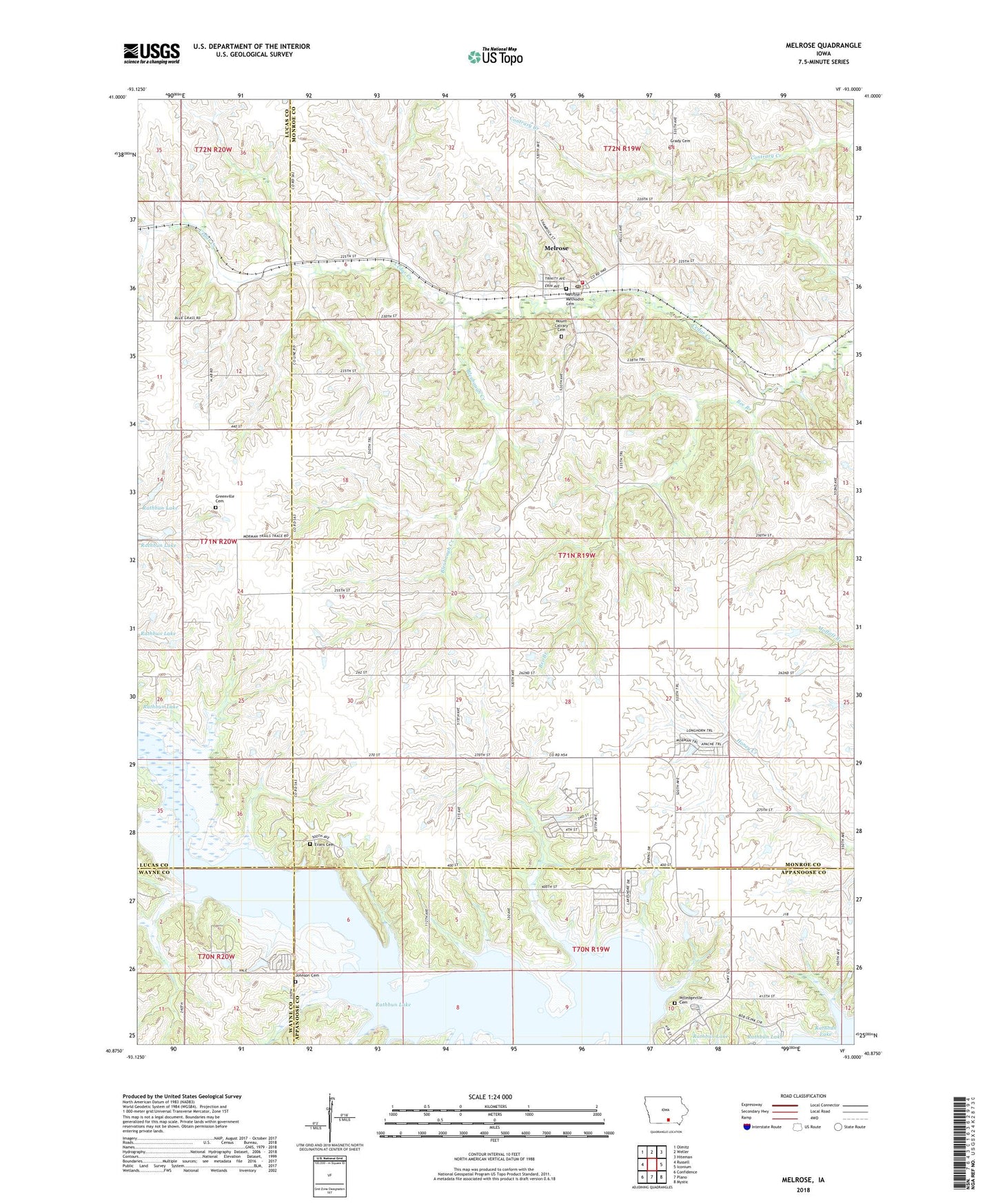
2022 topographic map quadrangle Melrose in the state of Iowa. Scale: 1:24000. Based on the newly updated USGS 7.5' US Topo map series, this map is in the following counties: Monroe, Lucas, Appanoose, Wayne. The map contains contour data, water features, and other items you are used to seeing on USGS maps, but also has updated roads and other features. This is the next generation of topographic maps. Printed on high-quality waterproof paper with UV fade-resistant inks.
Quads adjacent to this one:
West: Russell
Northwest: Olmitz
North: Weller
Northeast: Hiteman
East: Iconium
Southeast: Mystic
South: Plano
Southwest: Confidence
This map covers the same area as the classic USGS quad with code o40093h1.
Contains the following named places: Bee Branch, Blarney Stone Park, Bleubaugh Creek, Bridgeview Recreation Area, Bunker Hill School, City of Melrose, Evans Cemetery, Greenvale School, Greenville Cemetery, Greenville Post Office, Hardy Cemetery, Hazel Point School, Honey Creek, Jackoak School, Johnson Cemetery, Melrose, Melrose Community Hall, Melrose Fire Department, Melrose Methodist Cemetery, Melrose Post Office, Milledgeville Cemetery, Mound School, Mount Calvary Cemetery, Murphys Landing Strip, New Providence Baptist Church, Osprey Post Office, Osprey School, Pleasant Grove School, Pleasant Hill School, Prairie Center School, Rathbun State Wildlife Area, Saint Patricks Catholic Church, Tater Hill School, Tick Ridge School, Township of Jackson, ZIP Code: 52569