MyTopo
Russell Iowa US Topo Map
Couldn't load pickup availability
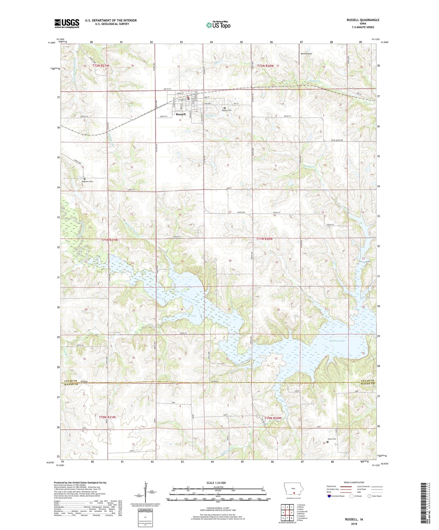
2022 topographic map quadrangle Russell in the state of Iowa. Scale: 1:24000. Based on the newly updated USGS 7.5' US Topo map series, this map is in the following counties: Lucas, Wayne. The map contains contour data, water features, and other items you are used to seeing on USGS maps, but also has updated roads and other features. This is the next generation of topographic maps. Printed on high-quality waterproof paper with UV fade-resistant inks.
Quads adjacent to this one:
West: Corydon NE
Northwest: Chariton
North: Olmitz
Northeast: Weller
East: Melrose
Southeast: Plano
South: Confidence
Southwest: Corydon
This map covers the same area as the classic USGS quad with code o40093h2.
Contains the following named places: Center Community Church, City of Russell, Colyn State Wildlife Area, Faith United Methodist Church, First Baptist Church, Goodwater Creek, Jones Cemetery, Lost Branch, Ragtown Branch, Ragtown Cemetery, Russell, Russell Cemetery, Russell Community School, Russell Mall, Russell Post Office, Russell Town Hall, Russell Volunteer Fire Department, Township of Washington, White School, Zero, Zero Post Office, ZIP Code: 50238