MyTopo
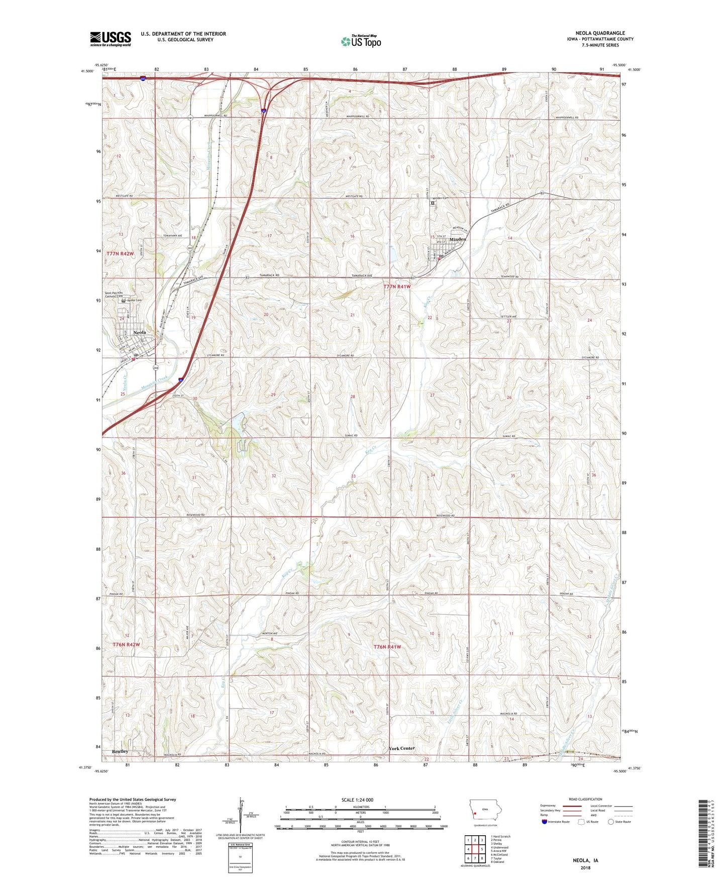
Neola Iowa US Topo Map
Couldn't load pickup availability
2022 topographic map quadrangle Neola in the state of Iowa. Scale: 1:24000. Based on the newly updated USGS 7.5' US Topo map series, this map is in the following counties: Pottawattamie. The map contains contour data, water features, and other items you are used to seeing on USGS maps, but also has updated roads and other features. This is the next generation of topographic maps. Printed on high-quality waterproof paper with UV fade-resistant inks.
Quads adjacent to this one:
West: Underwood
Northwest: Hard Scratch
North: Persia
Northeast: Shelby
East: Avoca NW
Southeast: Oakland
South: Taylor
Southwest: McClelland
This map covers the same area as the classic USGS quad with code o41095d5.
Contains the following named places: Arrowhead County Park, Bentley, Bentley Census Designated Place, Bentley Post Office, City of Minden, City of Neola, Cogley Physicians Clinic, First Presbyterian Church, Harvest Alliance Church, Minden, Minden City Hall, Minden Clinic, Minden Community Hall, Minden Dental Center, Minden Post Office, Minden Township Cemetery, Minden Volunteer Fire and Rescue, Neola, Neola City Hall, Neola Creek, Neola Elevator, Neola Family Dentistry Center, Neola Post Office, Neola Township Cemetery, Neola Volunteer Fire Department, Pleasant Valley School Number 3, Saint Patricks Catholic Church, Saint Patricks Cemetery, Township of Minden, Township of York, United Church of Christ, York Center, ZIP Code: 51553