MyTopo
Peterson SE Iowa US Topo Map
Couldn't load pickup availability
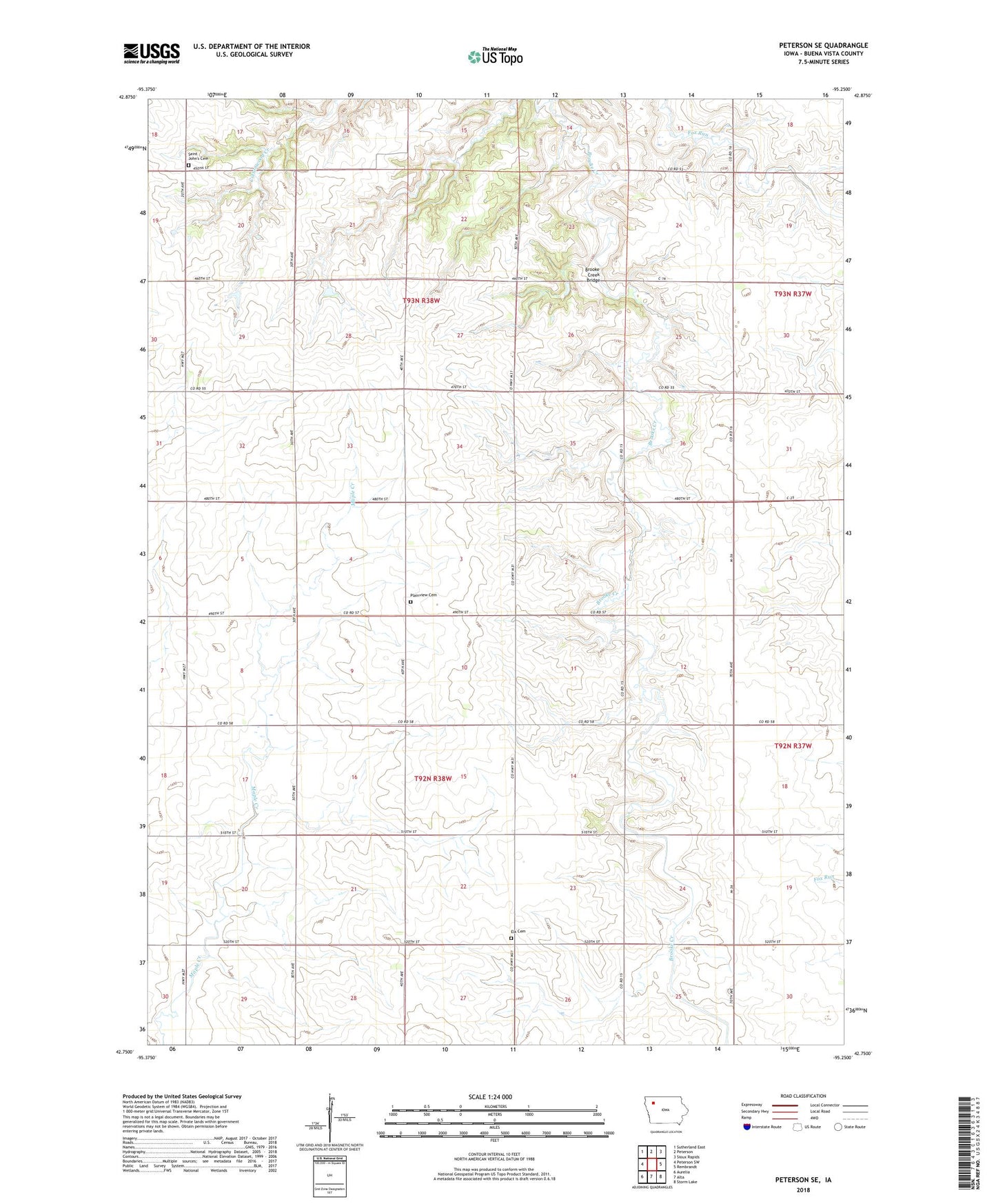
2022 topographic map quadrangle Peterson SE in the state of Iowa. Scale: 1:24000. Based on the newly updated USGS 7.5' US Topo map series, this map is in the following counties: Buena Vista. The map contains contour data, water features, and other items you are used to seeing on USGS maps, but also has updated roads and other features. This is the next generation of topographic maps. Printed on high-quality waterproof paper with UV fade-resistant inks.
Quads adjacent to this one:
West: Peterson SW
Northwest: Sutherland East
North: Peterson
Northeast: Sioux Rapids
East: Rembrandt
Southeast: Storm Lake
South: Alta
Southwest: Aurelia
This map covers the same area as the classic USGS quad with code o42095g3.
Contains the following named places: Brooke Creek Bridge, Elk Cemetery, Elk Church, Elkton, Elkton Post Office, Immanuel Church, Plainview Cemetery, Saint Johannes Cemetery, Saint John Church, Township of Brooke, Township of Elk, West Scott, West Scott Post Office, Westphal Farms