MyTopo
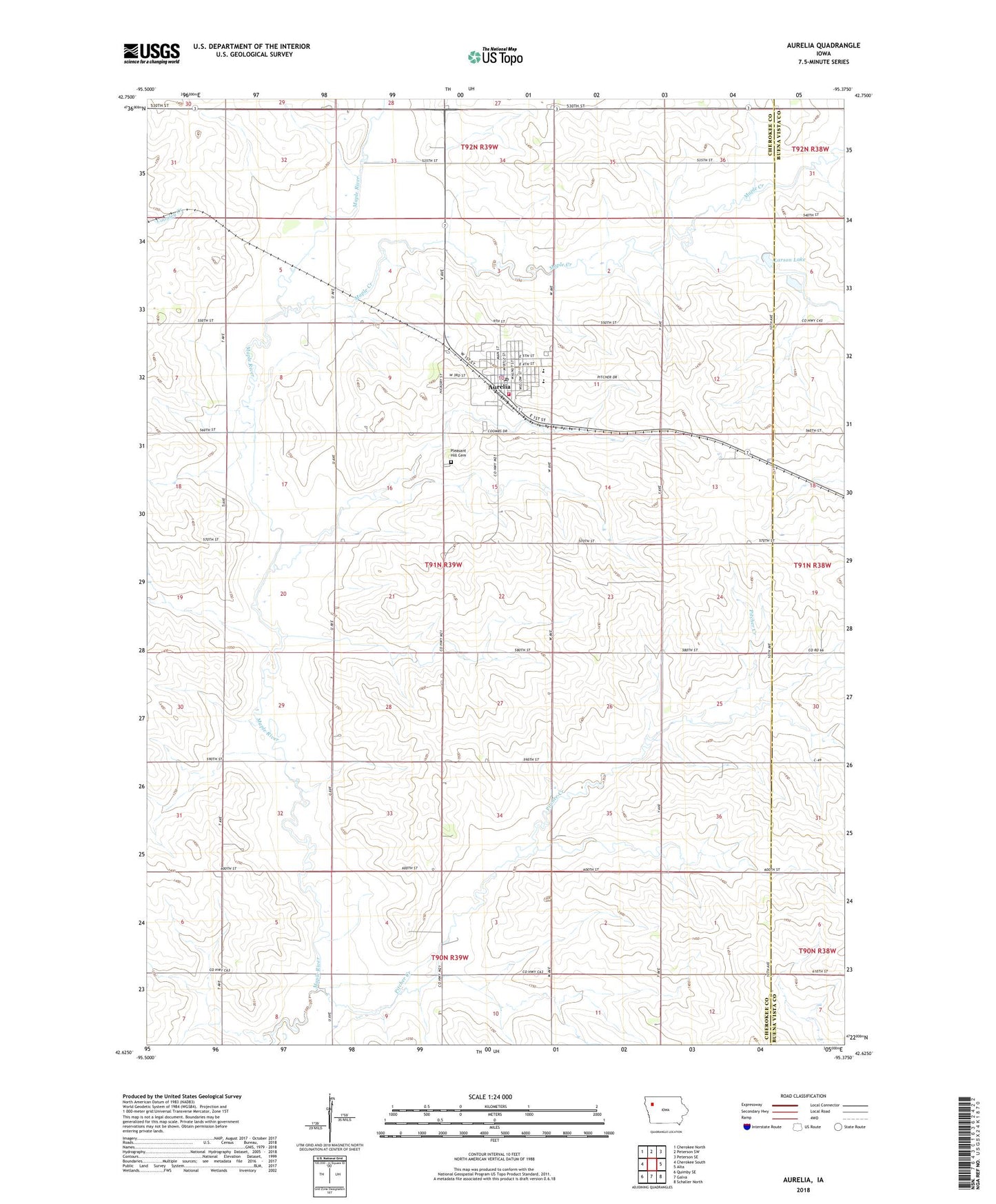
Aurelia Iowa US Topo Map
Couldn't load pickup availability
2022 topographic map quadrangle Aurelia in the state of Iowa. Scale: 1:24000. Based on the newly updated USGS 7.5' US Topo map series, this map is in the following counties: Cherokee, Buena Vista. The map contains contour data, water features, and other items you are used to seeing on USGS maps, but also has updated roads and other features. This is the next generation of topographic maps. Printed on high-quality waterproof paper with UV fade-resistant inks.
Quads adjacent to this one:
West: Cherokee South
Northwest: Cherokee North
North: Peterson SW
Northeast: Peterson SE
East: Alta
Southeast: Schaller North
South: Galva
Southwest: Quimby SE
This map covers the same area as the classic USGS quad with code o42095f4.
Contains the following named places: Alta - Aurelia Middle School, Aurelia, Aurelia Country Club, Aurelia Elementary School, Aurelia Fire Department, Aurelia Medical Clinic, Aurelia Police Department, Aurelia Post Office, Aurelia Public Library, Bradfield Farms, City of Aurelia, Congregational United Church, Farmers Co-op Elevator, First United Methodist Church, Kludas Farms, Larson Lake, Larson Lake County Park, Maple Creek, Maplewood Farms, Mier Farms, Nester Stiles State Preserve, Pitcher Creek, Pleasant Hill Cemetery, Prescott Prairie, Saint Paul Lutheran Church, Southern Acres Mobile Estates, Stellish Farm, Stender Farm, Sunset Knoll Retirement Home, Township of Pitcher, ZIP Code: 51005