MyTopo
Peterson SW Iowa US Topo Map
Couldn't load pickup availability
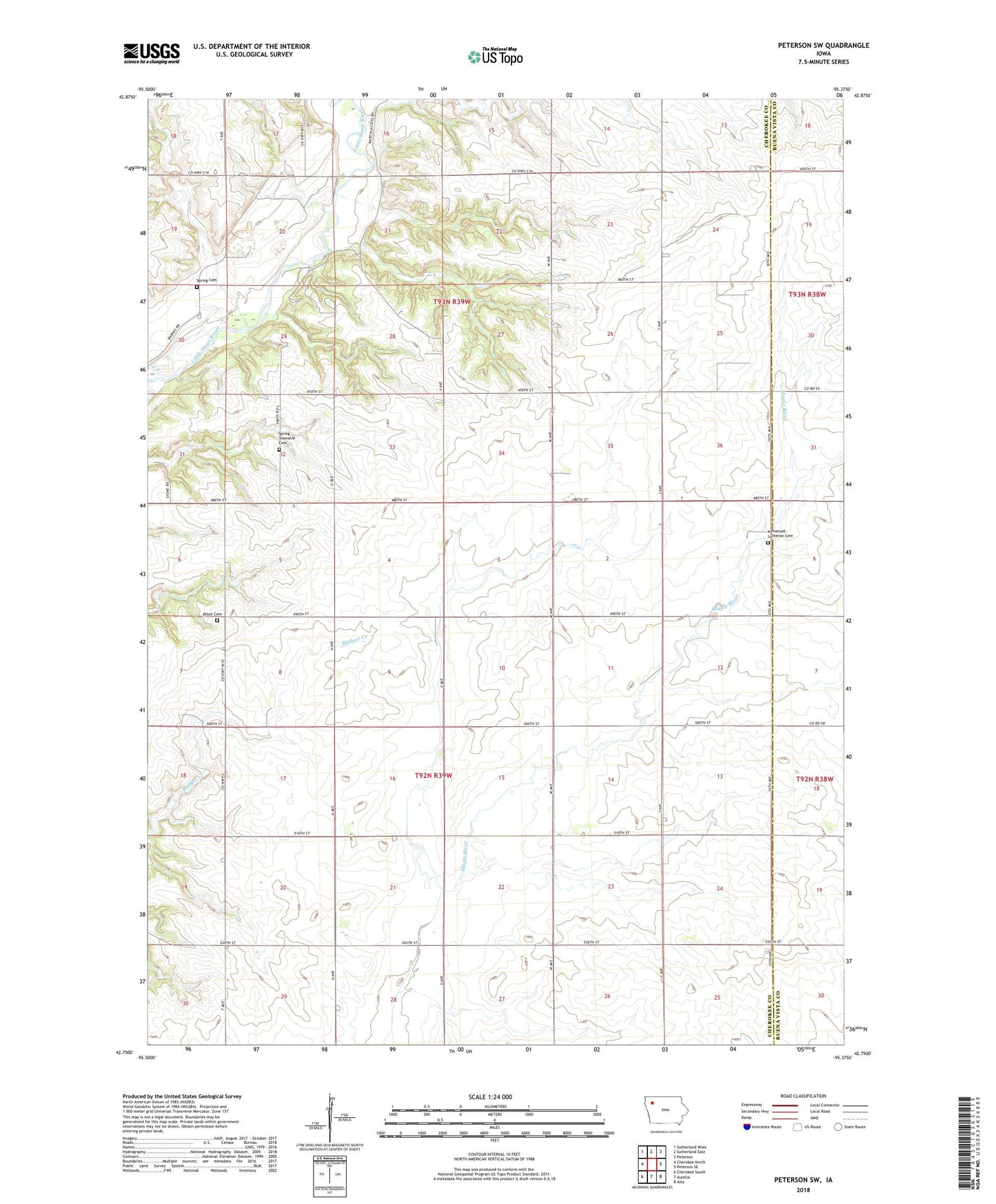
2022 topographic map quadrangle Peterson SW in the state of Iowa. Scale: 1:24000. Based on the newly updated USGS 7.5' US Topo map series, this map is in the following counties: Cherokee, Buena Vista. The map contains contour data, water features, and other items you are used to seeing on USGS maps, but also has updated roads and other features. This is the next generation of topographic maps. Printed on high-quality waterproof paper with UV fade-resistant inks.
Quads adjacent to this one:
West: Cherokee North
Northwest: Sutherland West
North: Sutherland East
Northeast: Peterson
East: Peterson SE
Southeast: Alta
South: Aurelia
Southwest: Cherokee South
This map covers the same area as the classic USGS quad with code o42095g4.
Contains the following named places: Afton Cemetery, Batten Farms, Booth Farms, Burch Farm, Carlson Farms, Immanuel Church, Immanuel Lutheran Cemetery, Johnson Farm, Maple, Martin Area County Park, Nelson Area County Park, Pingel Farms, Rodada Farm, Smith Farms, Spring Cemetery, Spring Township Cemetery, Stange Farm, Thunder Valley Farms, Township of Afton, Township of Spring