MyTopo
Sutherland East Iowa US Topo Map
Couldn't load pickup availability
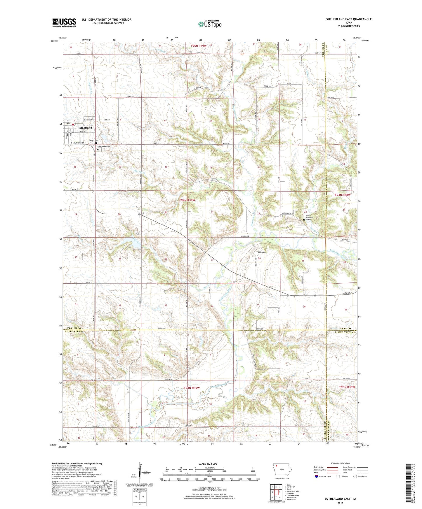
2022 topographic map quadrangle Sutherland East in the state of Iowa. Scale: 1:24000. Based on the newly updated USGS 7.5' US Topo map series, this map is in the following counties: O'Brien, Cherokee, Clay, Buena Vista. The map contains contour data, water features, and other items you are used to seeing on USGS maps, but also has updated roads and other features. This is the next generation of topographic maps. Printed on high-quality waterproof paper with UV fade-resistant inks.
Quads adjacent to this one:
West: Sutherland West
Northwest: Gaza
North: Hartley SW
Northeast: Royal
East: Peterson
Southeast: Peterson SE
South: Peterson SW
Southwest: Cherokee North
This map covers the same area as the classic USGS quad with code o42095h4.
Contains the following named places: Bethel Lutheran Church, Calvary Cemetery, Camp Yo-Lo-To-Go, City of Sutherland, Dog Creek, Dog Creek County Park, Dog Creek Dam, First Settlement in O'Brien County Historical Marker, Fred Fieldman Grave, General N B Baker Library, Hannibal Waterman Cemetery, Henry Creek, Hill Little Sioux Overlook, Indian Village State Park, Jordan Creek, Jurgensen Farms, Lenhart Dairy, McCormack Area, Millies Rest Home, Murray Creek, Negus Recreation Area, O'Brien, O'Brien Post Office, Old Dutch Fred Access, Sacred Heart Catholic Church, Soo River Access, Sutherland, Sutherland Family Medicine Center, Sutherland Farmers Co-op Elevator, Sutherland Fire Rescue and Ambulance, Sutherland Post Office, Township of Waterman, Waterman, Waterman Cemetery, Waterman Creek, Waterman Post Office, Waterman Prairie Wildlife Management Area, Wurth Chiropractic Clinic, ZIP Code: 51058