MyTopo
Rose Hill Iowa US Topo Map
Couldn't load pickup availability
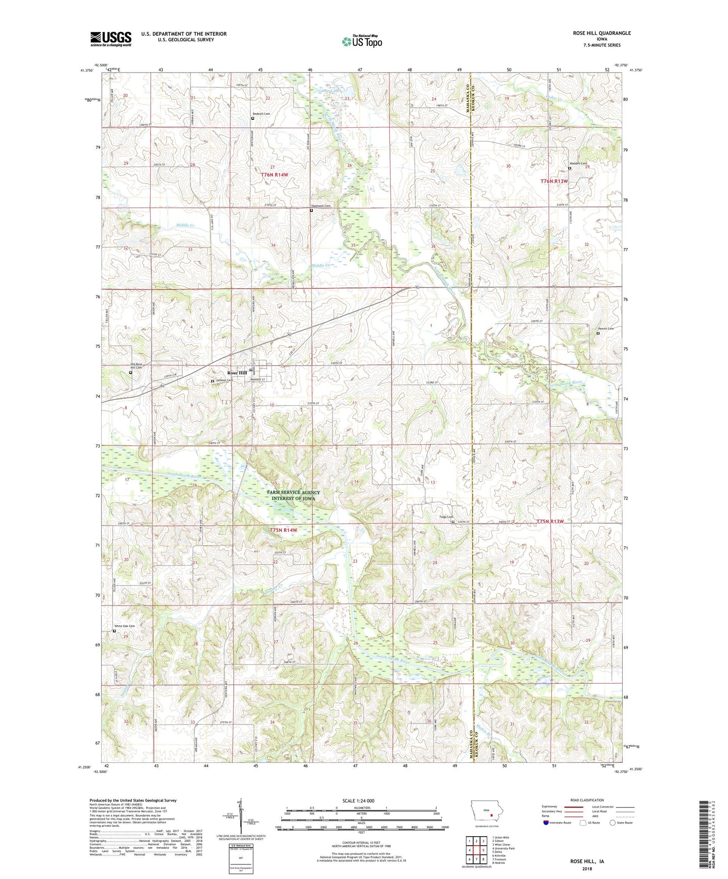
2022 topographic map quadrangle Rose Hill in the state of Iowa. Scale: 1:24000. Based on the newly updated USGS 7.5' US Topo map series, this map is in the following counties: Mahaska, Keokuk. The map contains contour data, water features, and other items you are used to seeing on USGS maps, but also has updated roads and other features. This is the next generation of topographic maps. Printed on high-quality waterproof paper with UV fade-resistant inks.
Quads adjacent to this one:
West: University Park
Northwest: Union Mills
North: Gibson
Northeast: What Cheer
East: Delta
Southeast: Hedrick
South: Fremont
Southwest: Kirkville
This map covers the same area as the classic USGS quad with code o41092c4.
Contains the following named places: Atwood, Atwood Post Office, Bedwell Cemetery, City of Rose Hill, Goose Lake, Hewitt Cemetery, Hopewell Cemetery, Hopewell Post Office, Jackson Cemetery, Mattix Branch, Middle Creek, North White Oak School, Old Rose Hill Cemetery, Old Rose Hill School, Olive Branch, Rose Hill, Rose Hill Community Church, Rose Hill Marsh, Rose Hill Post Office, Rosehill, Snyder Creek, Tioga, Tioga Cemetery, Tioga Church, Tioga Post Office, Township of White Oak, Union Chapel, Waddell Cemetery, White Oak, White Oak Conservation Area, White Oak Grove Cemetery, White Oak Grove Church, White Oak Post Office, ZIP Code: 52586