MyTopo
Fremont Iowa US Topo Map
Couldn't load pickup availability
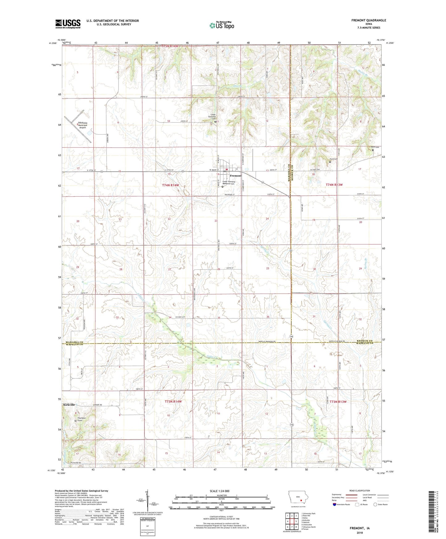
2022 topographic map quadrangle Fremont in the state of Iowa. Scale: 1:24000. Based on the newly updated USGS 7.5' US Topo map series, this map is in the following counties: Mahaska, Wapello, Keokuk. The map contains contour data, water features, and other items you are used to seeing on USGS maps, but also has updated roads and other features. This is the next generation of topographic maps. Printed on high-quality waterproof paper with UV fade-resistant inks.
Quads adjacent to this one:
West: Kirkville
Northwest: University Park
North: Rose Hill
Northeast: Delta
East: Hedrick
Southeast: Farson
South: Ottumwa North
Southwest: Chillicothe
This map covers the same area as the classic USGS quad with code o41092b4.
Contains the following named places: Baptist Church, Cedar Township Cemetery, Cedar Township Memorial Cemetery, Church of the Nazarene, City of Fremont, DeVol Area, Ford Cemetery, Fremont, Fremont City Hall, Fremont Elementary School, Fremont Elevator, Fremont Fire Department, Fremont Middle School, Fremont Post Office, Fremont United Methodist Church, Helm Cemetery, Oskaloosa Municipal Airport, Spring Branch, Thompson Grave, Township of Cedar, Twin Pine Mobile Home Park, ZIP Code: 52561