MyTopo
Kirkville Iowa US Topo Map
Couldn't load pickup availability
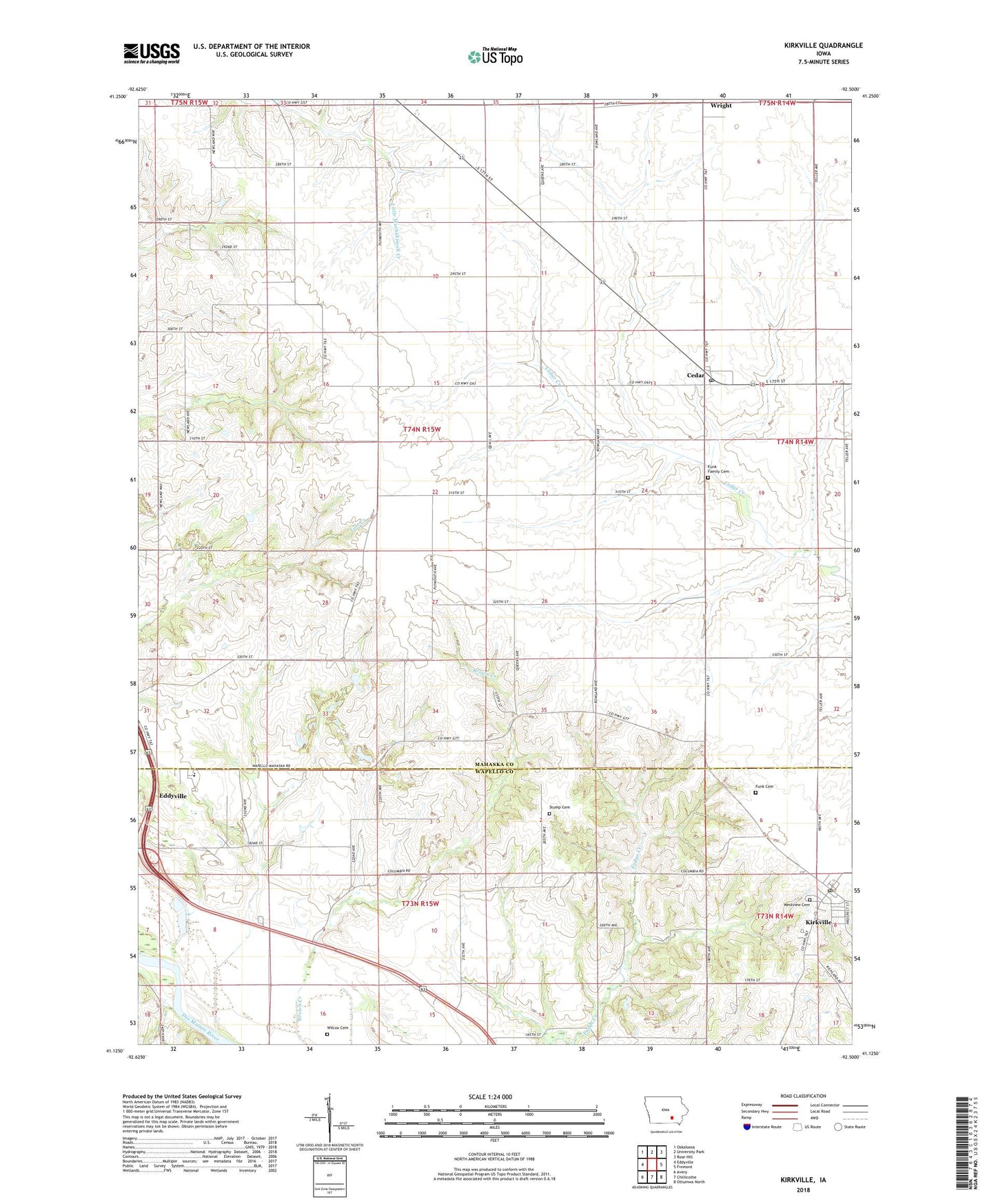
2022 topographic map quadrangle Kirkville in the state of Iowa. Scale: 1:24000. Based on the newly updated USGS 7.5' US Topo map series, this map is in the following counties: Mahaska, Wapello. The map contains contour data, water features, and other items you are used to seeing on USGS maps, but also has updated roads and other features. This is the next generation of topographic maps. Printed on high-quality waterproof paper with UV fade-resistant inks.
Quads adjacent to this one:
West: Eddyville
Northwest: Oskaloosa
North: University Park
Northeast: Rose Hill
East: Fremont
Southeast: Ottumwa North
South: Chillicothe
Southwest: Avery
This map covers the same area as the classic USGS quad with code o41092b5.
Contains the following named places: Cedar, Cedar Post Office, Cedar United Methodist Church, Christian Reformed Church, City of Kirkville, Eddyville - Blakesburg - Fremont Junior / Senior High School, Funk Cemetery, Funk Family Cemetery, Kirkville, Kirkville Post Office, Lostcreek Post Office, Nicholson Park, Pekay Post Office, Stump Cemetery, Township of Harrison, Westview Cemetery, Wilcox Cemetery, Wright, Wright Community Church, Wright Post Office, ZIP Codes: 52543, 52566