MyTopo
Hedrick Iowa US Topo Map
Couldn't load pickup availability
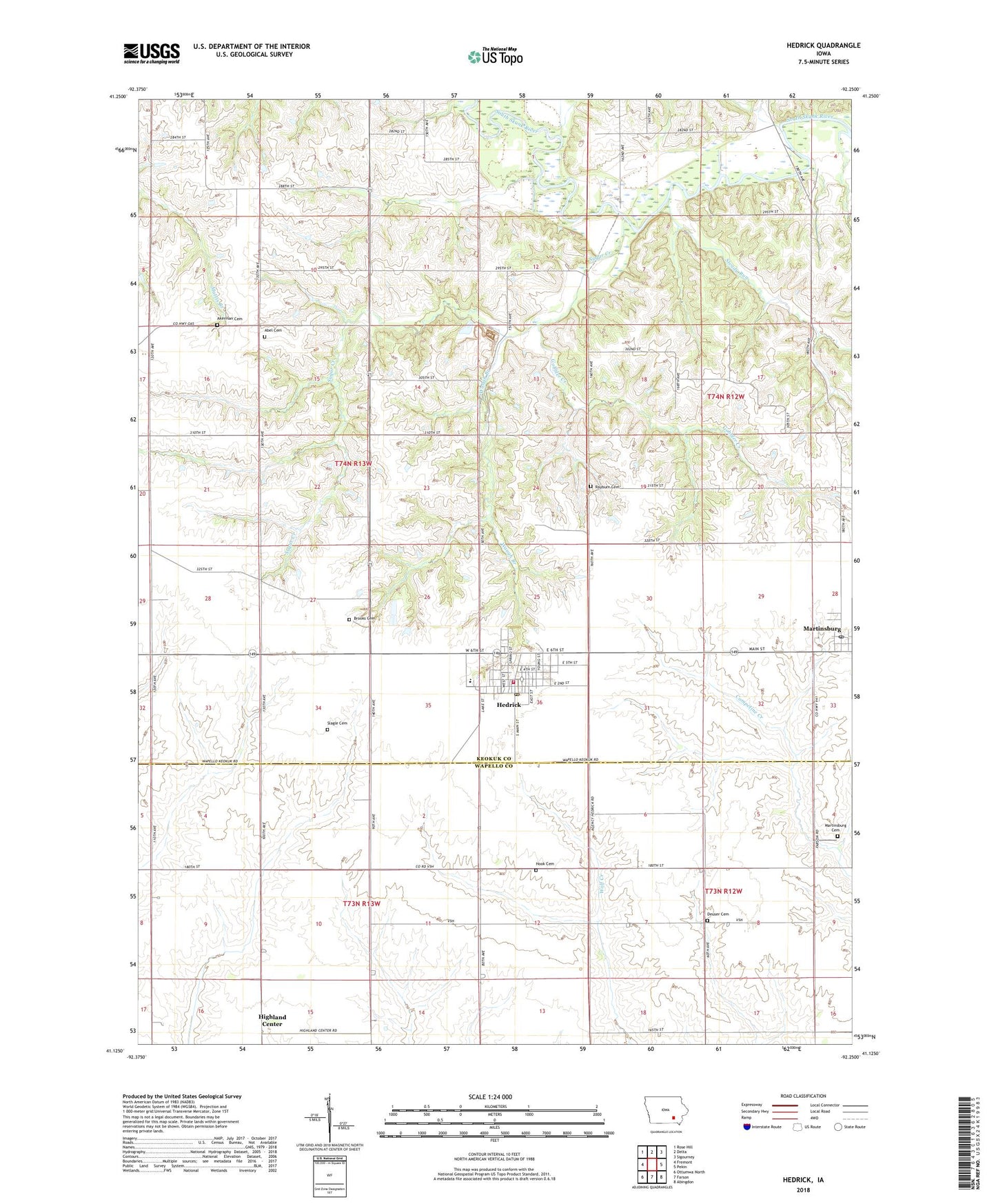
2022 topographic map quadrangle Hedrick in the state of Iowa. Scale: 1:24000. Based on the newly updated USGS 7.5' US Topo map series, this map is in the following counties: Keokuk, Wapello. The map contains contour data, water features, and other items you are used to seeing on USGS maps, but also has updated roads and other features. This is the next generation of topographic maps. Printed on high-quality waterproof paper with UV fade-resistant inks.
Quads adjacent to this one:
West: Fremont
Northwest: Rose Hill
North: Delta
Northeast: Sigourney
East: Pekin
Southeast: Abingdon
South: Farson
Southwest: Ottumwa North
This map covers the same area as the classic USGS quad with code o41092b3.
Contains the following named places: Abel Cemetery, Akerman Cemetery, Brooks Cemetery, Butler, Butler Post Office, City of Hedrick, City of Martinsburg, Deuser Cemetery, First Christian Church, Full Gospel Church, Gobbler Creek, Hedrick, Hedrick City Hall, Hedrick Elevator Incorporated Elevator, Hedrick First Responders, Hedrick Library, Hedrick Medical Clinic, Hedrick Post Office, Hedrick United Methodist Church, Hedrick Volunteer Fire Department, Highland Center, Highland Center Post Office, Hook Cemetery, Lutheran Church, Martinsburg, Martinsburg Cemetery, Martinsburg Post Office, Martinsburg United Methodist Church, Pekin Alternative High School, Rayburn Cemetery, Showman, Showman Post Office, Slagle Cemetery, Steady Run, Sugar Creek, Township of Benton, Union Chapel, Waugh Branch, ZIP Code: 52563