MyTopo
Fontanelle Iowa US Topo Map
Couldn't load pickup availability
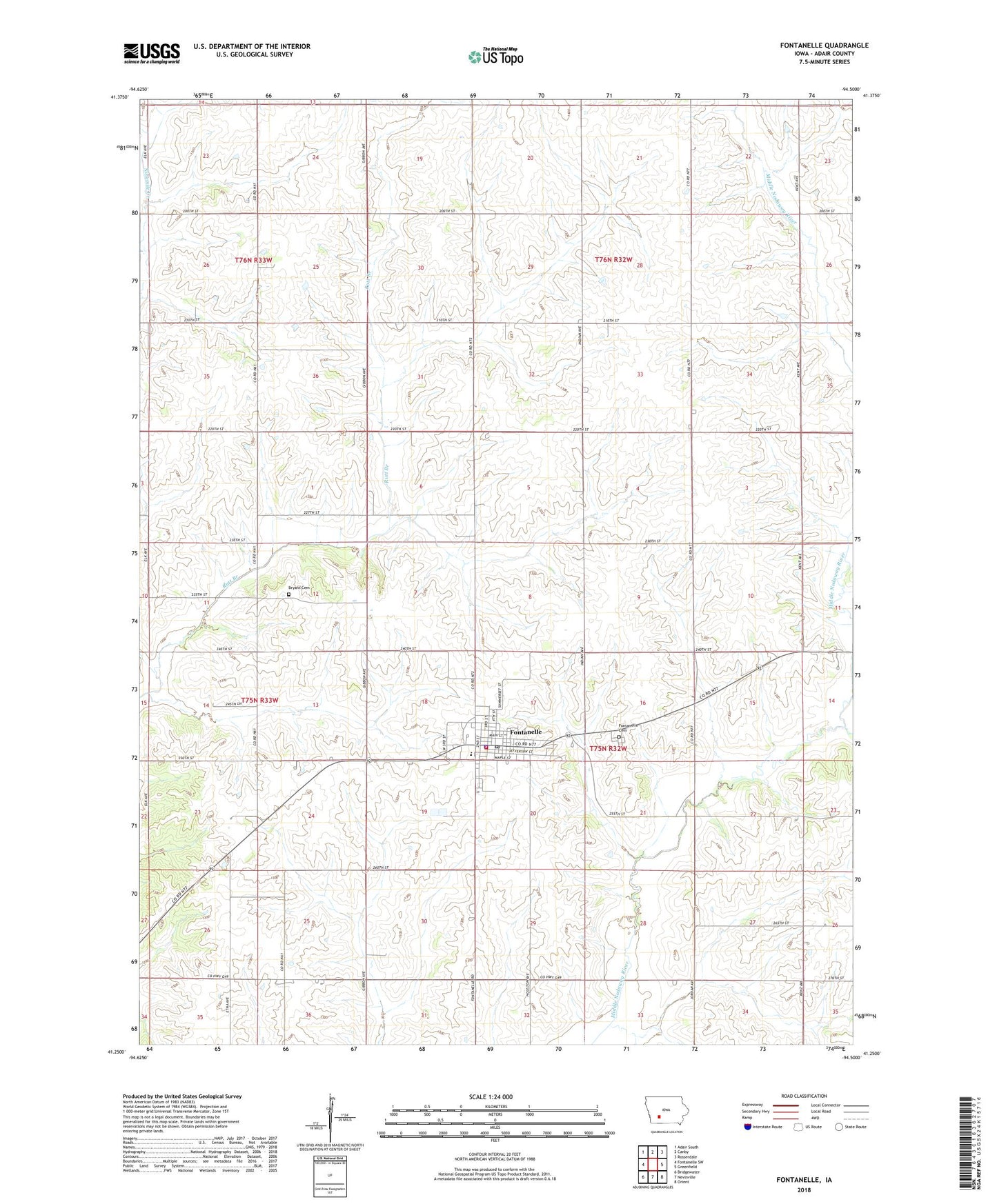
2022 topographic map quadrangle Fontanelle in the state of Iowa. Scale: 1:24000. Based on the newly updated USGS 7.5' US Topo map series, this map is in the following counties: Adair. The map contains contour data, water features, and other items you are used to seeing on USGS maps, but also has updated roads and other features. This is the next generation of topographic maps. Printed on high-quality waterproof paper with UV fade-resistant inks.
Quads adjacent to this one:
West: Fontanelle SW
Northwest: Adair South
North: Canby
Northeast: Rosserdale
East: Greenfield
Southeast: Orient
South: Nevinville
Southwest: Bridgewater
This map covers the same area as the classic USGS quad with code o41094c5.
Contains the following named places: Adair Wildlife Management Area, Bryant Cemetery, City of Fontanelle, Emmanuel Lutheran Church, Fontanelle, Fontanelle Cemetery, Fontanelle City Fire Department, Fontanelle Library, Fontanelle Medical Center, Fontanelle Police Department, Fontanelle Post Office, Fontanelle Town Hall, Good Samaritan Center, Highland Church, Highway 92 Wildlife Area, Nodaway Valley Middle School, Prussia, Prussia Centre, Prussia Centre Post Office, Township of Prussia, Township of Summerset, United Methodist Church, ZIP Code: 50846