MyTopo
Ryan Iowa US Topo Map
Couldn't load pickup availability
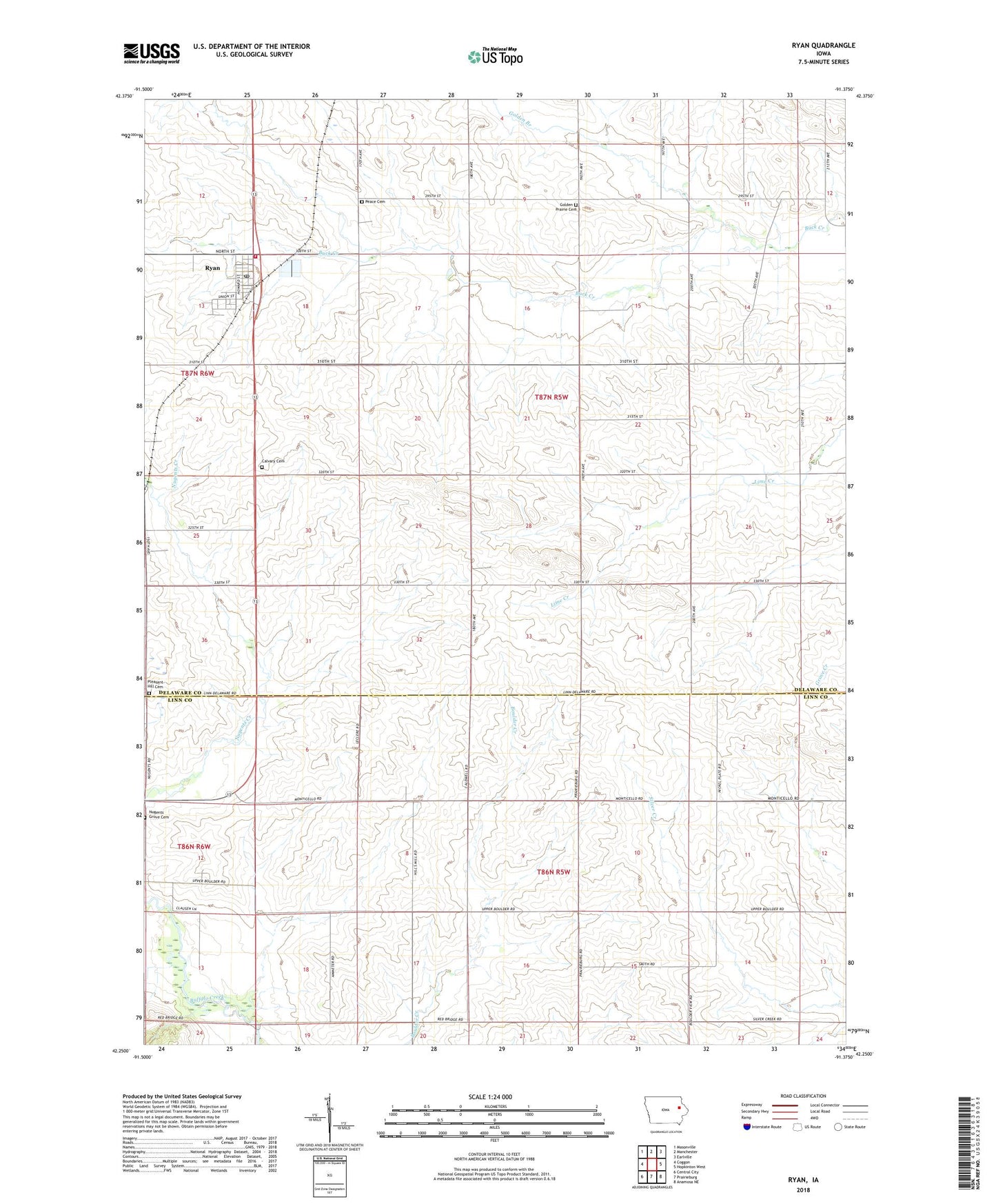
2022 topographic map quadrangle Ryan in the state of Iowa. Scale: 1:24000. Based on the newly updated USGS 7.5' US Topo map series, this map is in the following counties: Delaware, Linn. The map contains contour data, water features, and other items you are used to seeing on USGS maps, but also has updated roads and other features. This is the next generation of topographic maps. Printed on high-quality waterproof paper with UV fade-resistant inks.
Quads adjacent to this one:
West: Coggon
Northwest: Masonville
North: Manchester
Northeast: Earlville
East: Hopkinton West
Southeast: Anamosa NE
South: Prairieburg
Southwest: Central City
This map covers the same area as the classic USGS quad with code o42091c4.
Contains the following named places: Abbeyville Post Office, Almira Post Office, Broadway Post Office, Calvary Cemetery, City of Ryan, Golden Branch, Golden Church, Golden Prairie Cemetery, Hazel Green, Hazle Green, Hazlegreen Post Office, LeClere Landing Strip, Lycurgus School, Mangoldville Post Office, Nugents Grove Cemetery, Peace Lutheran Cemetery, Peace Lutheran Church, Pleasant Hill Cemetery, Ryan, Ryan Fire Department, Ryan Post Office, Saint Patrick's Church, Township of Boulder, Township of Hazel Green