MyTopo
Saude Iowa US Topo Map
Couldn't load pickup availability
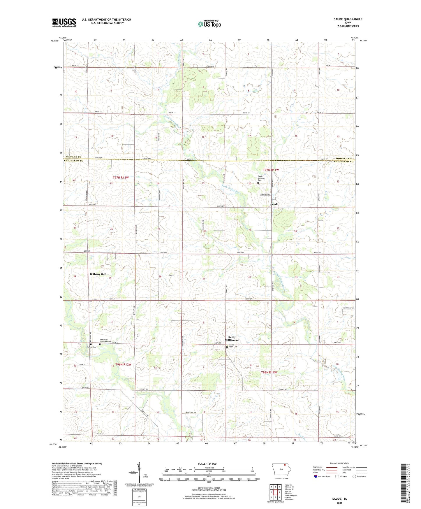
2022 topographic map quadrangle Saude in the state of Iowa. Scale: 1:24000. Based on the newly updated USGS 7.5' US Topo map series, this map is in the following counties: Chickasaw, Howard. The map contains contour data, water features, and other items you are used to seeing on USGS maps, but also has updated roads and other features. This is the next generation of topographic maps. Printed on high-quality waterproof paper with UV fade-resistant inks.
Quads adjacent to this one:
West: Jerico
Northwest: Lourdes
North: Cresco SW
Northeast: Cresco SE
East: Protivin
Southeast: Waucoma
South: Lawler
Southwest: New Hampton
This map covers the same area as the classic USGS quad with code o43092b2.
Contains the following named places: Bethany Hall, Crane Creek Lutheran Cemetery, Dale Post Office, Immanuel Lutheran Church, Little Turkey Creek, Nansen Post Office, Oakdale Post Office, Reilly Settlement, Sacred Heart Cemetery, Sacred Heart Church, Saude, Saude Lutheran Cemetery, Saude Lutheran Church, Saude Lutheran School, Saude Park, Saude Post Office, Stephen Wildlife Area, Township of Utica, Yankee Cemetery, Zillo