MyTopo
Rising Sun Iowa US Topo Map
Couldn't load pickup availability
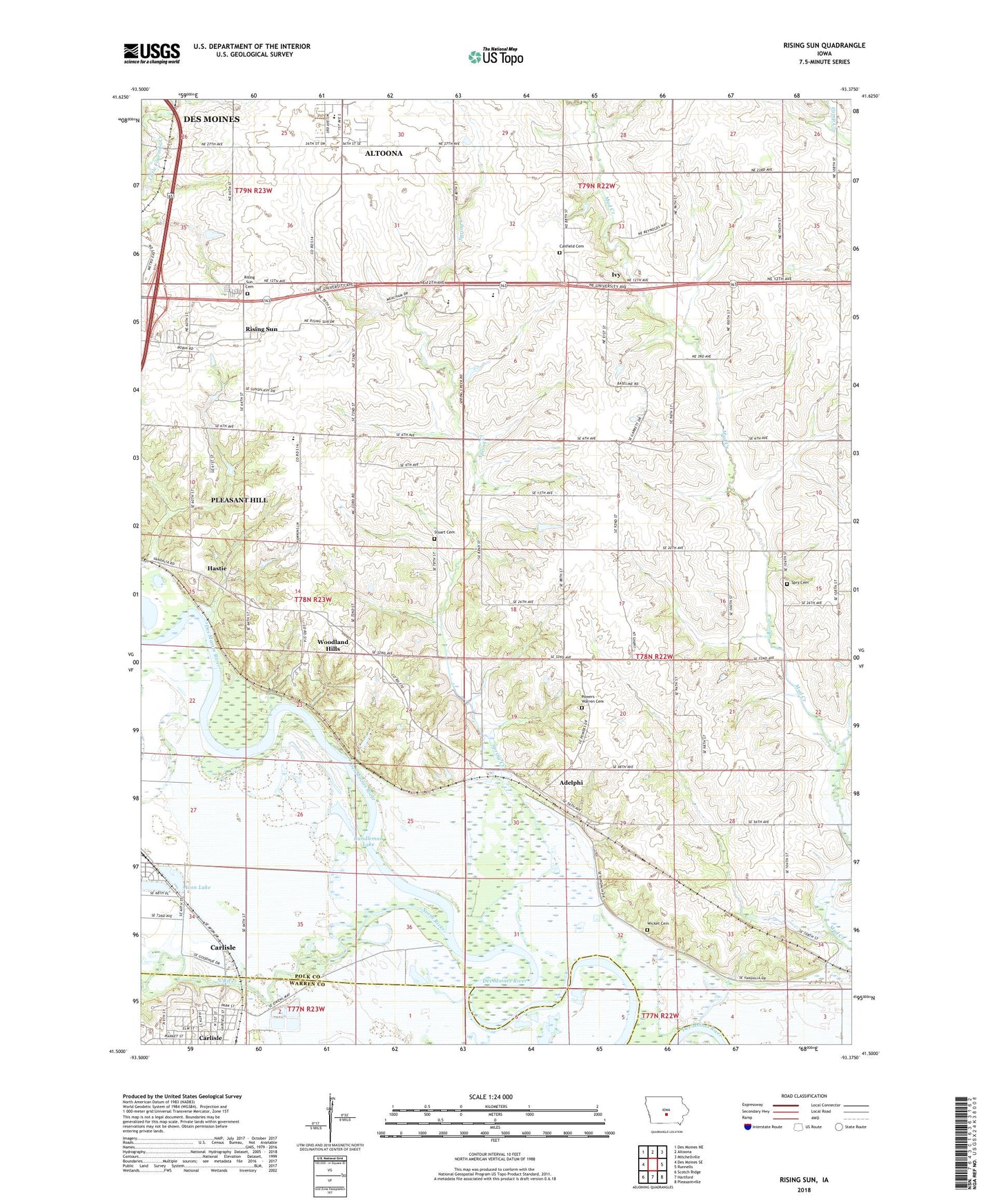
2022 topographic map quadrangle Rising Sun in the state of Iowa. Scale: 1:24000. Based on the newly updated USGS 7.5' US Topo map series, this map is in the following counties: Polk, Warren. The map contains contour data, water features, and other items you are used to seeing on USGS maps, but also has updated roads and other features. This is the next generation of topographic maps. Printed on high-quality waterproof paper with UV fade-resistant inks.
Quads adjacent to this one:
West: Des Moines SE
Northwest: Des Moines NE
North: Altoona
Northeast: Mitchellville
East: Runnells
Southeast: Pleasantville
South: Hartford
Southwest: Scotch Ridge
This map covers the same area as the classic USGS quad with code o41093e4.
Contains the following named places: Adelphi, Adelphi Post Office, Avon Lake, Calvary Church, Camp Center Church, Camp Post Office, Canfield Cemetery, Carleton, Carleton Post Office, Carlisle, Carlisle Christian Church, Carlisle City Hall, Carlisle City Park, Carlisle Community Church, Carlisle Water Treatment Plant, City of Carlisle, City of Pleasant Hill, Clarkson, Clarkson Post Office, Clay Elementary School, De Louis Field, Four Mile Elementary School, Grace Community Church, Hastie, Hastie Post Office, Ivy, Ivy Centennial United Methodist Church, Ivy Post Office, Midway Post Office, North River, Oakwood Station, Randleman Lake, Rising Sun, Rising Sun Cemetery, Rising Sun Church of Christ, Rising Sun Post Office, Southeast Polk High School, Southeast Polk Junior High School, Spring Creek, Spry Cemetery, Stuart Cemetery, Toad Valley Public Golf Course, Township of Camp, Township of Four Mile, Warren - Powers Cemetery, Wicker Cemetery, Woodland Hills, Woodland Hills Church of Christ, ZIP Code: 50327