MyTopo
Plano Iowa US Topo Map
Couldn't load pickup availability
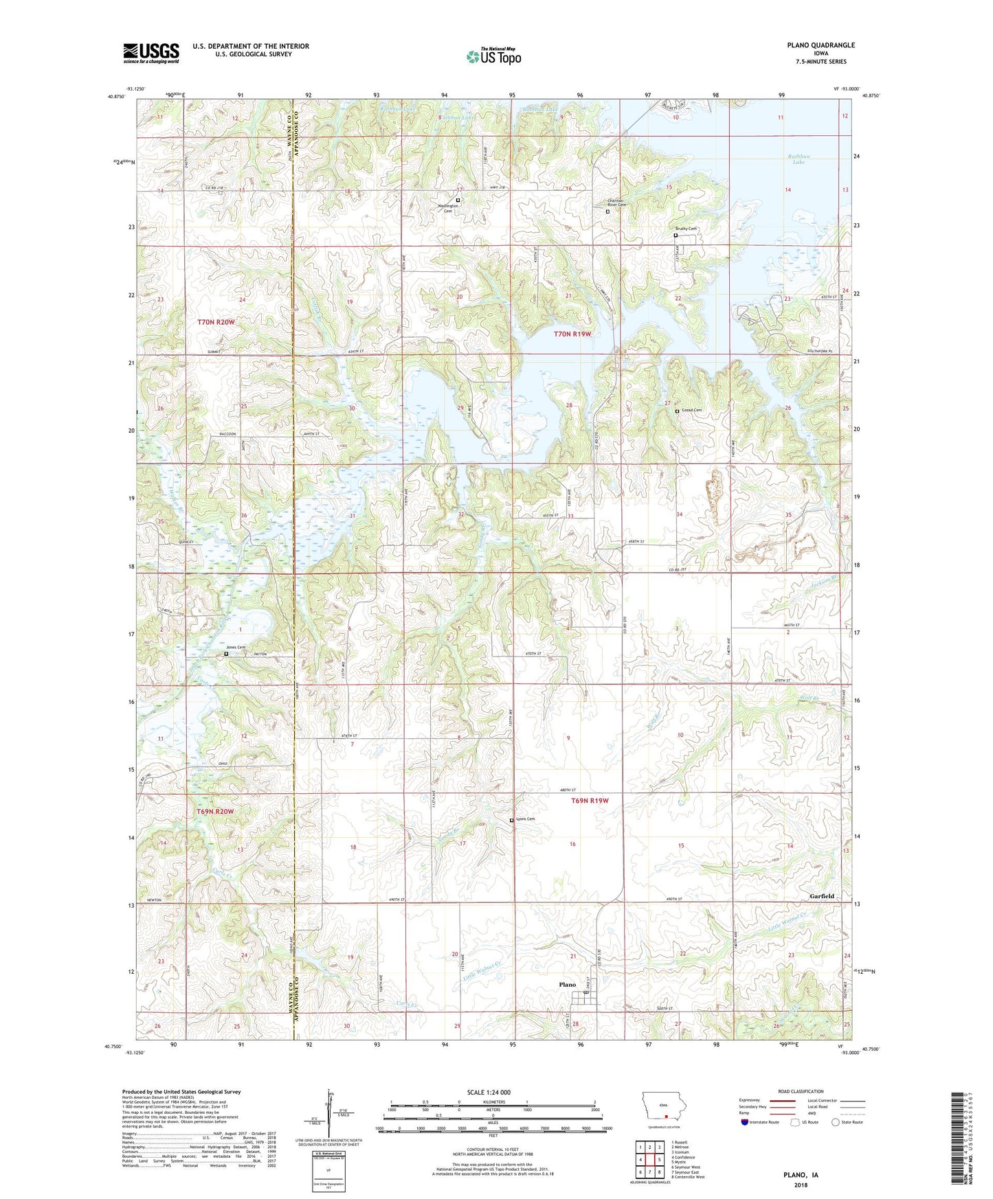
2022 topographic map quadrangle Plano in the state of Iowa. Scale: 1:24000. Based on the newly updated USGS 7.5' US Topo map series, this map is in the following counties: Appanoose, Wayne. The map contains contour data, water features, and other items you are used to seeing on USGS maps, but also has updated roads and other features. This is the next generation of topographic maps. Printed on high-quality waterproof paper with UV fade-resistant inks.
Quads adjacent to this one:
West: Confidence
Northwest: Russell
North: Melrose
Northeast: Iconium
East: Mystic
Southeast: Centerville West
South: Seymour East
Southwest: Seymour West
This map covers the same area as the classic USGS quad with code o40093g1.
Contains the following named places: Brushy Cemetery, Carls Creek, Catfish Branch, Charitan River Cemetery, Chariton River Church, City of Plano, Cozad Cemetery, Garfield, Garfield Post Office, Griffinsville, Griffinsville Post Office, Jackson Branch, Jones Cemetery, Jones Church, Lyon Family Cemetery, Memphis Post Office, Milledgeville, Milledgeville Post Office, Niles Post Office, North Bend Church, Plano, Plano Post Office, Plano Recreation Area, Rathbun Lake, Sandy Branch, South Fork Chariton River, South Fork Walker Branch, Township of Independence, Township of Johns, Tranquillity, Wadlington Cemetery, Walker Branch, ZIP Code: 52581