MyTopo
Confidence Iowa US Topo Map
Couldn't load pickup availability
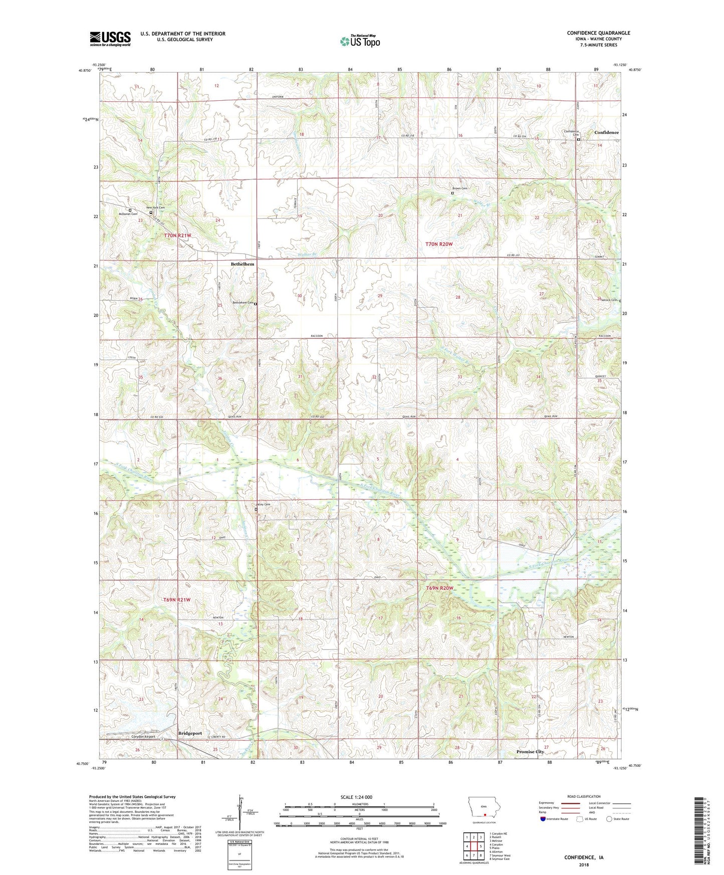
2022 topographic map quadrangle Confidence in the state of Iowa. Scale: 1:24000. Based on the newly updated USGS 7.5' US Topo map series, this map is in the following counties: Wayne. The map contains contour data, water features, and other items you are used to seeing on USGS maps, but also has updated roads and other features. This is the next generation of topographic maps. Printed on high-quality waterproof paper with UV fade-resistant inks.
Quads adjacent to this one:
West: Corydon
Northwest: Corydon NE
North: Russell
Northeast: Melrose
East: Plano
Southeast: Seymour East
South: Seymour West
Southwest: Allerton
This map covers the same area as the classic USGS quad with code o40093g2.
Contains the following named places: Adcock Cemetery, Bethel Church, Bethelhem, Bethlehem Cemetery, Bethlehem Church, Bethlehem Post Office, Bridgeport, Brown Cemetery, Confidence, Confidence Cemetery, Confidence Post Office, Corydon Airport, Crow Creek, Dodril Cemetery, Jackson Creek, Jordan Creek, Lacey Cemetery, McDaniel Cemetery, New York Cemetery, Sunnyslope Church, Township of South Fork, Township of Wright, Una Post Office, ZIP Code: 52583