MyTopo
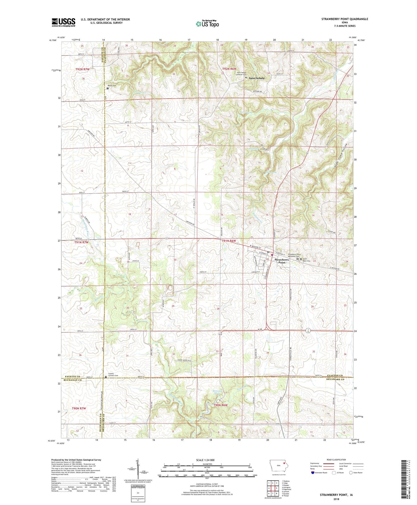
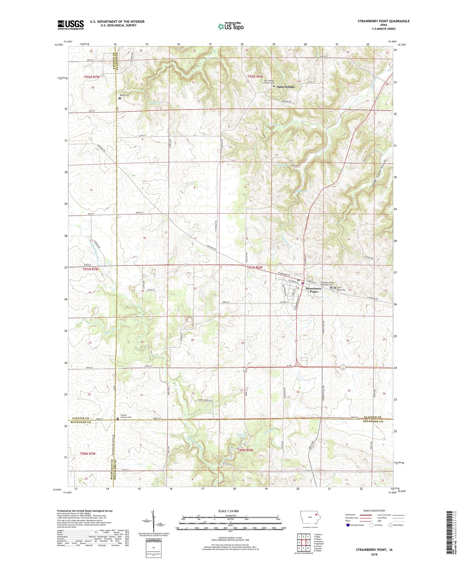
Strawberry Point Iowa US Topo Map
Couldn't load pickup availability
2022 topographic map quadrangle Strawberry Point in the state of Iowa. Scale: 1:24000. Based on the newly updated USGS 7.5' US Topo map series, this map is in the following counties: Clayton, Delaware, Fayette, Buchanan. The map contains contour data, water features, and other items you are used to seeing on USGS maps, but also has updated roads and other features. This is the next generation of topographic maps. Printed on high-quality waterproof paper with UV fade-resistant inks.
Quads adjacent to this one:
West: Arlington
Northwest: Wadena
North: Volga
Northeast: Elkader
East: Edgewood
Southeast: Thorpe
South: Dundee
Southwest: Lamont
This map covers the same area as the classic USGS quad with code o42091f5.
Contains the following named places: Backbone Golf and Country Club, Backbone State Forest, Baron Spring, Believers in Grace Fellowship, Big Spring, Bruce Creek, Camp Ewalu, Cass Post Office, City of Strawberry Point, Community Bible Church, County Corners Cemetery, Emmanuel Lutheran Church, Fenchel Creek, Independent District Pleasant Prairie School, Joy Springs County Park, Maquoketa River Wildlife Area, Old Mission Road Historical Marker, Reed Cemetery, Richmond Spring, Saint Mary Cemetery, Saint Marys Catholic Church, Saint Sebald, Saint Sebald Lutheran Cemetery, Saint Sebald Post Office, Saint Sebalds Lutheran Church, South Spring, Strawberry Point, Strawberry Point Ambulance Service, Strawberry Point Chiropractic Clinic, Strawberry Point City Hall, Strawberry Point City Police Department, Strawberry Point Fire and Rescue, Strawberry Point Library, Strawberry Point Lutheran Home, Strawberry Point Medical Center, Strawberry Point Medical Center Heliport, Strawberry Point Methodist Cemetery, Strawberry Point Post Office, Sugar Camp Hollow, Township of Cass, United Methodist Church, Wilder Memorial Museum, ZIP Code: 52076