MyTopo
Elkader Iowa US Topo Map
Couldn't load pickup availability
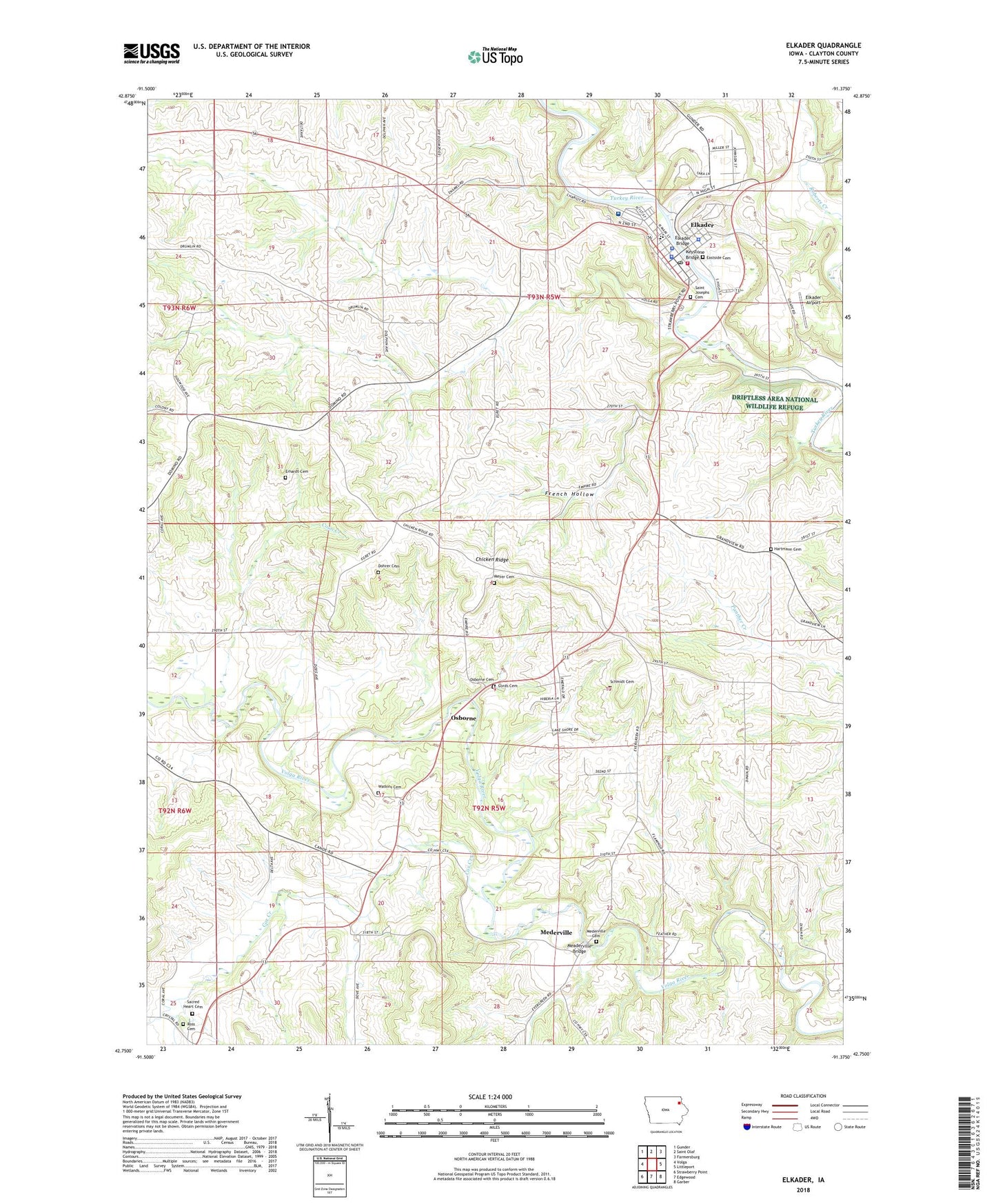
2022 topographic map quadrangle Elkader in the state of Iowa. Scale: 1:24000. Based on the newly updated USGS 7.5' US Topo map series, this map is in the following counties: Clayton. The map contains contour data, water features, and other items you are used to seeing on USGS maps, but also has updated roads and other features. This is the next generation of topographic maps. Printed on high-quality waterproof paper with UV fade-resistant inks.
Quads adjacent to this one:
West: Volga
Northwest: Gunder
North: Saint Olaf
Northeast: Farmersburg
East: Littleport
Southeast: Garber
South: Edgewood
Southwest: Strawberry Point
This map covers the same area as the classic USGS quad with code o42091g4.
Contains the following named places: Ardell Kader City Park, Bethany Lutheran Church, Carter House Museum, Central Ambulance Service, Central Community Elementary School, Central Community Hospital, Central Community Hospital Heliport, Central Community Junior - Senior High School, Chicken Ridge, Chicken Ridge Scenic Overlook Park, City of Elkader, Clayton County Courthouse, Clayton County Office Building, Clayton County Sheriff, Community Chiropractic Center, Coon Creek, Cords Cemetery, Cox Creek, Cox Creek Post Office, Cox Creek Rest Area, Cox Creek Townhall, Dohrer Cemetery, Elkader, Elkader Airport, Elkader Bridge, Elkader Care Center, Elkader Cemetery, Elkader Chiropractic Clinic, Elkader City Park, Elkader Eye Clinic, Elkader Fire Department, Elkader Golf and Country Club, Elkader Medical Associates Center, Elkader Police Department, Elkader Post Office, Elkader Public Library, Erhardt Cemetery, First Congregational Church, French Hollow, Grace Evangelical Free Church, Hartmann Cemetery, Jehovahs Witnesses Kingdom Hall, KADR-AM (Elkader), Keystone Bridge, Lovers Leap Park, Meaderville Bridge, Mederville, Mederville Access, Mederville Cemetery, Mederville Post Office, Meyer Cemetery, Osborne, Osborne Cemetery, Osborne Conservation Center, Osborne Post Office, Peace United Church of Christ, Pony Hollow Trail, Riverside Park, Ross Cemetery, Sacred Heart Cemetery, Saint Josephs Cemetery, Saint Josephs Church, Saint Patrick Station, Schmidt Cemetery, Table Rock Site of July 4 1838 Celebration Historical Marker, Township of Boardman, Township of Cox Creek, Turkey River Park, Watkins Cemetery, Zion Lutheran Church, ZIP Code: 52043