MyTopo
Kellogg Iowa US Topo Map
Couldn't load pickup availability
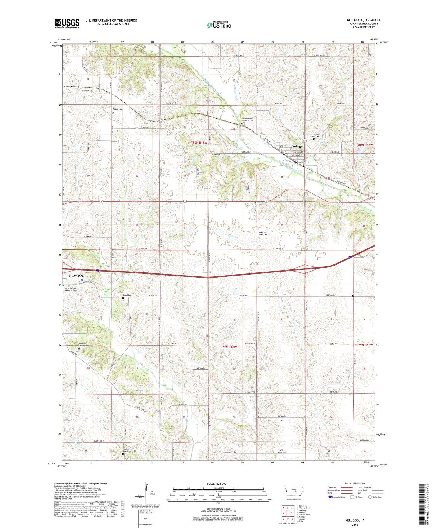
2022 topographic map quadrangle Kellogg in the state of Iowa. Scale: 1:24000. Based on the newly updated USGS 7.5' US Topo map series, this map is in the following counties: Jasper. The map contains contour data, water features, and other items you are used to seeing on USGS maps, but also has updated roads and other features. This is the next generation of topographic maps. Printed on high-quality waterproof paper with UV fade-resistant inks.
Quads adjacent to this one:
West: Newton
Northwest: Baxter SE
North: Alloway Creek
Northeast: Newburg
East: Oakland Acres
Southeast: Sully
South: Killduff
Southwest: Monroe
This map covers the same area as the classic USGS quad with code o41092f8.
Contains the following named places: Adamson Grove Cemetery, Adamsonville, Adamsonville Post Office, Alloway Creek, Amboy, Amboy Post Office, Antle Cemetery, Beacon Light School, Burr Oak Creek, Center Friends Cemetery, Center Friends Church, Christian Church, City of Kellogg, Coon Creek, Jasper County Burial Ground, Jasper County Home, Jasper County Jail, Jasper County Sheriff's Office, Kellogg, Kellogg City Hall, Kellogg Historical Museum, Kellogg Post Office, Kellogg RV Park, Kellogg State Game Management Area, Kellogg Township Fire and Ambulance Department, Lutheran Church, Mount Zion Cemetery, Mount Zion Church, Murphy, Murphy Post Office, Old German Lutheran Cemetery, Our Silent City Cemetery, Pleasant View Cemetery, Pleasant View Church, Pleasant View Post Office, Rock Creek Number Seven School, Saums Cemetery, Slagel Cemetery, Township of Buena Vista, Township of Kellogg, United Methodist Church