MyTopo
Killduff Iowa US Topo Map
Couldn't load pickup availability
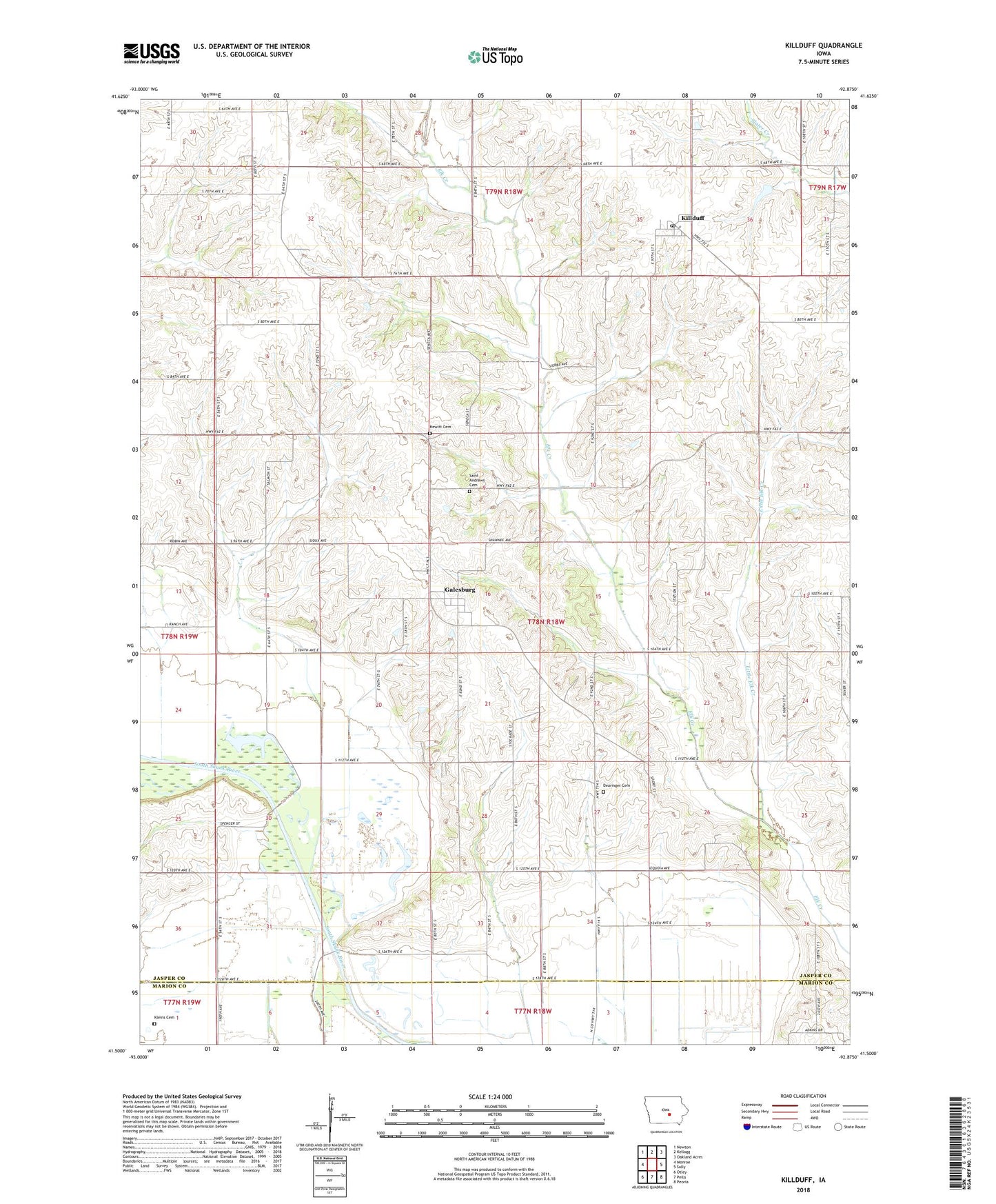
2022 topographic map quadrangle Killduff in the state of Iowa. Scale: 1:24000. Based on the newly updated USGS 7.5' US Topo map series, this map is in the following counties: Jasper, Marion. The map contains contour data, water features, and other items you are used to seeing on USGS maps, but also has updated roads and other features. This is the next generation of topographic maps. Printed on high-quality waterproof paper with UV fade-resistant inks.
Quads adjacent to this one:
West: Monroe
Northwest: Newton
North: Kellogg
Northeast: Oakland Acres
East: Sully
Southeast: Peoria
South: Pella
Southwest: Otley
This map covers the same area as the classic USGS quad with code o41092e8.
Contains the following named places: Dairy Grove Post Office, Dearinger Cemetery, Elk Creek Post Office, Galesburg, Galesburg Post Office, Hewitt Cemetery, Killduff, Killduff Fire Department, Killduff Post Office, Killduff United Methodist Church, Kleins Cemetery, Little Elk Creek, Saint Andrews Cemetery, Saint Andrews Church, South Skunk River Wildlife Area, Township of Elk Creek, Van Zante Creek, ZIP Code: 50232