MyTopo
Sumner Iowa US Topo Map
Couldn't load pickup availability
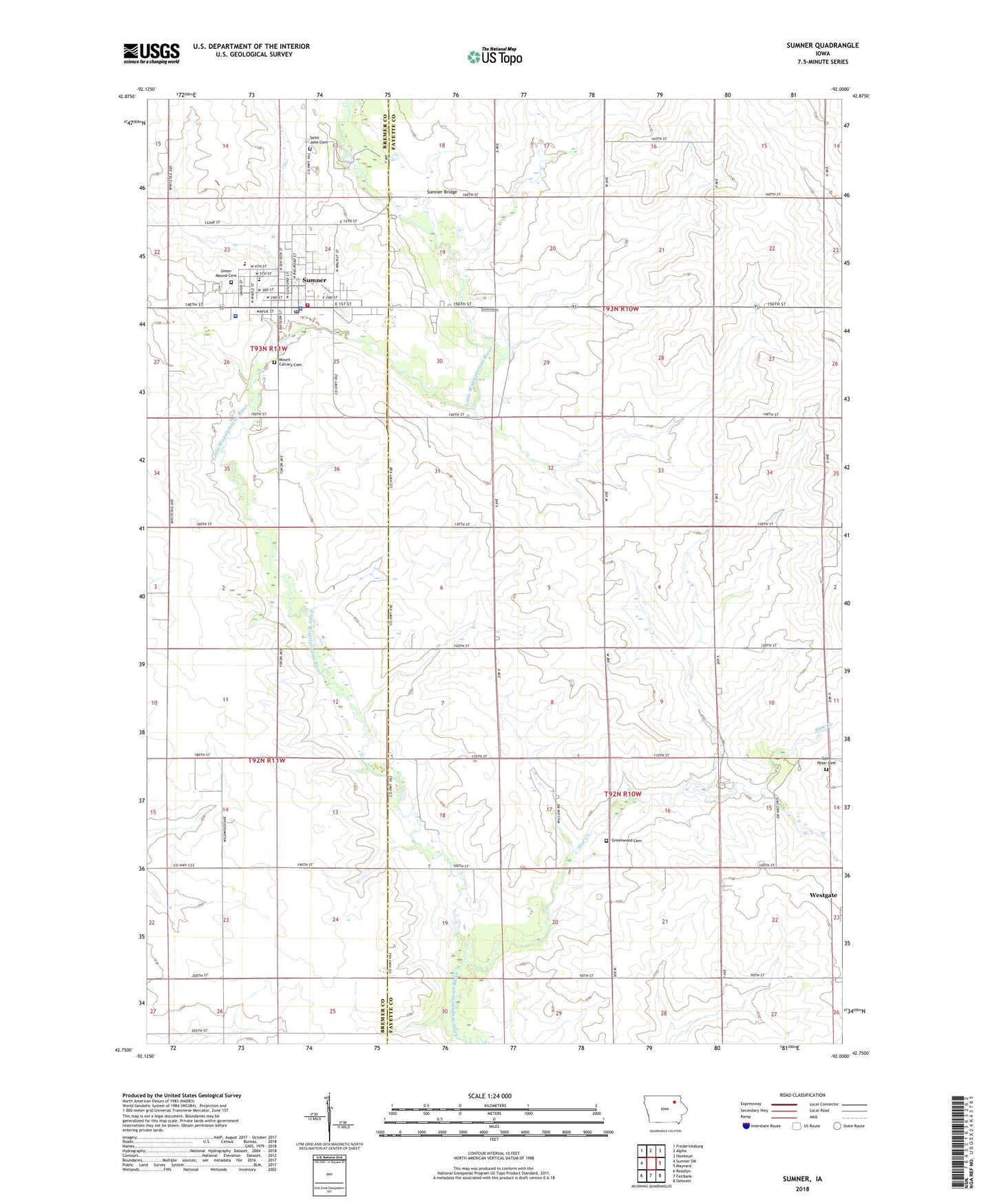
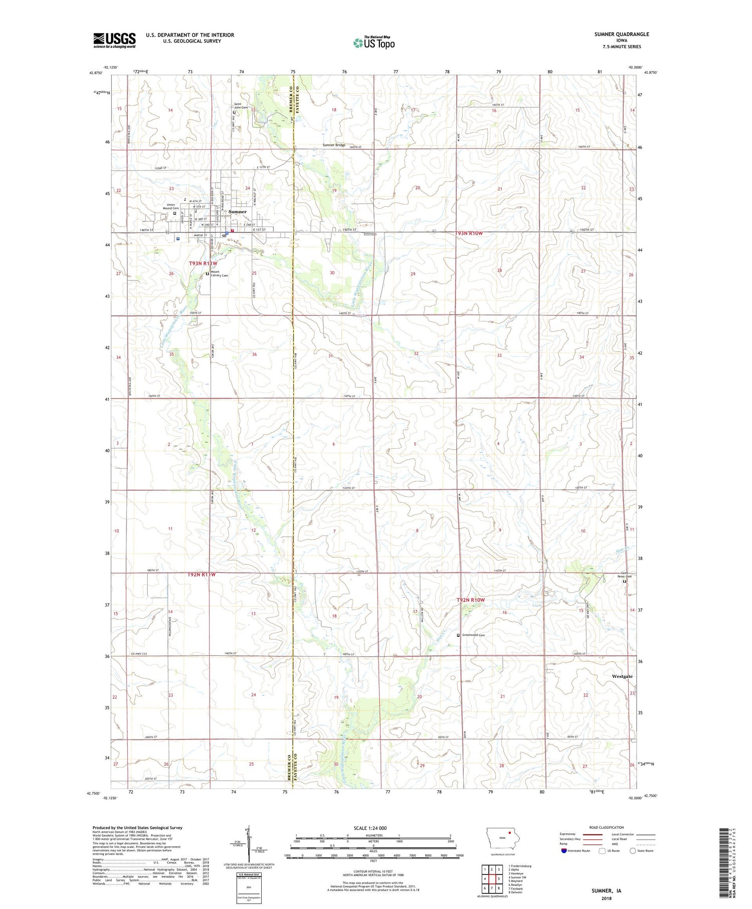
2022 topographic map quadrangle Sumner in the state of Iowa. Scale: 1:24000. Based on the newly updated USGS 7.5' US Topo map series, this map is in the following counties: Fayette, Bremer. The map contains contour data, water features, and other items you are used to seeing on USGS maps, but also has updated roads and other features. This is the next generation of topographic maps. Printed on high-quality waterproof paper with UV fade-resistant inks.
Quads adjacent to this one:
West: Sumner SW
Northwest: Fredericksburg
North: Alpha
Northeast: Hawkeye
East: Maynard
Southeast: Oelwein
South: Fairbank
Southwest: Readlyn
This map covers the same area as the classic USGS quad with code o42092g1.
Contains the following named places: Bauer Chiropractic Clinic, City of Sumner, Community Memorial Hospital, Cub Park, Durant Elementary School, Faith Evangelical Church, First Baptist Church, Fredericksburg Farmers Cooperative Elevator, Greenwood Cemetery, Haw Dental Clinic, Immaculate Conception Church, Koeberle Park, Mary Winks Park, Meadowbrook Country Club, Mill Post Office, Mount Calvary Cemetery, Murphy Church, North Woods County Park, Saint John Lutheran Church, Saint Johns Lutheran Cemetery, Saint Pauls Lutheran Church, Saint Peter Lutheran Cemetery, Stoe Creek, Sumner, Sumner - Fredericksburg High School, Sumner Bridge, Sumner City Park, Sumner Emergency Medical Services, Sumner Fire Department, Sumner Junior High School, Sumner Medical Clinic, Sumner Police Department, Sumner Post Office, Sumner Public Library, Township of Banks, Township of Fremont, Union Mound Cemetery, United Methodist Church, Water Tower Park, Wilsons Creek, ZIP Codes: 50674, 50681