MyTopo
Sumner SW Iowa US Topo Map
Couldn't load pickup availability
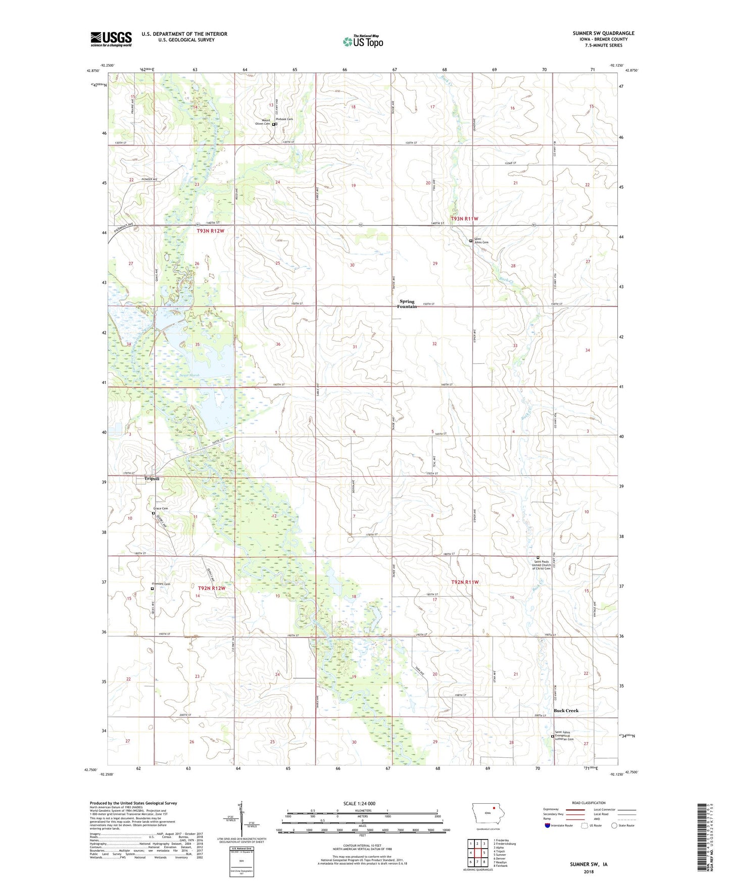
2022 topographic map quadrangle Sumner SW in the state of Iowa. Scale: 1:24000. Based on the newly updated USGS 7.5' US Topo map series, this map is in the following counties: Bremer. The map contains contour data, water features, and other items you are used to seeing on USGS maps, but also has updated roads and other features. This is the next generation of topographic maps. Printed on high-quality waterproof paper with UV fade-resistant inks.
Quads adjacent to this one:
West: Tripoli
Northwest: Frederika
North: Fredericksburg
Northeast: Alpha
East: Sumner
Southeast: Fairbank
South: Readlyn
Southwest: Denver
This map covers the same area as the classic USGS quad with code o42092g2.
Contains the following named places: Bremer, Buck Creek, Buckcreek Post Office, Dayton Post Office, East Fork Wapsipinicon River, Fremont Cemetery, Grace Cemetery, Leroy Post Office, Maynard Co-op Company Elevator, Mount Olivet Cemetery, Pinhook Cemetery, Plum Creek Wildlife Area, Priebe Landing Field, Saint Johns Cemetery, Saint Johns Lutheran Cemetery Buck Creek, Saint Johns Lutheran Church, Saint Johns School, Saint Pauls Church, Saint Pauls United Church of Christ Cemetery, Schwerin Landing Strip, Spring Fountain, Sweet Marsh, Sweet Marsh State Wildlife Management Area, Sweet Water Creek, Township of Dayton, Township of Le Roy, Township of Sumner Number 2, Wilsons Grove