MyTopo
Fredericksburg Iowa US Topo Map
Couldn't load pickup availability
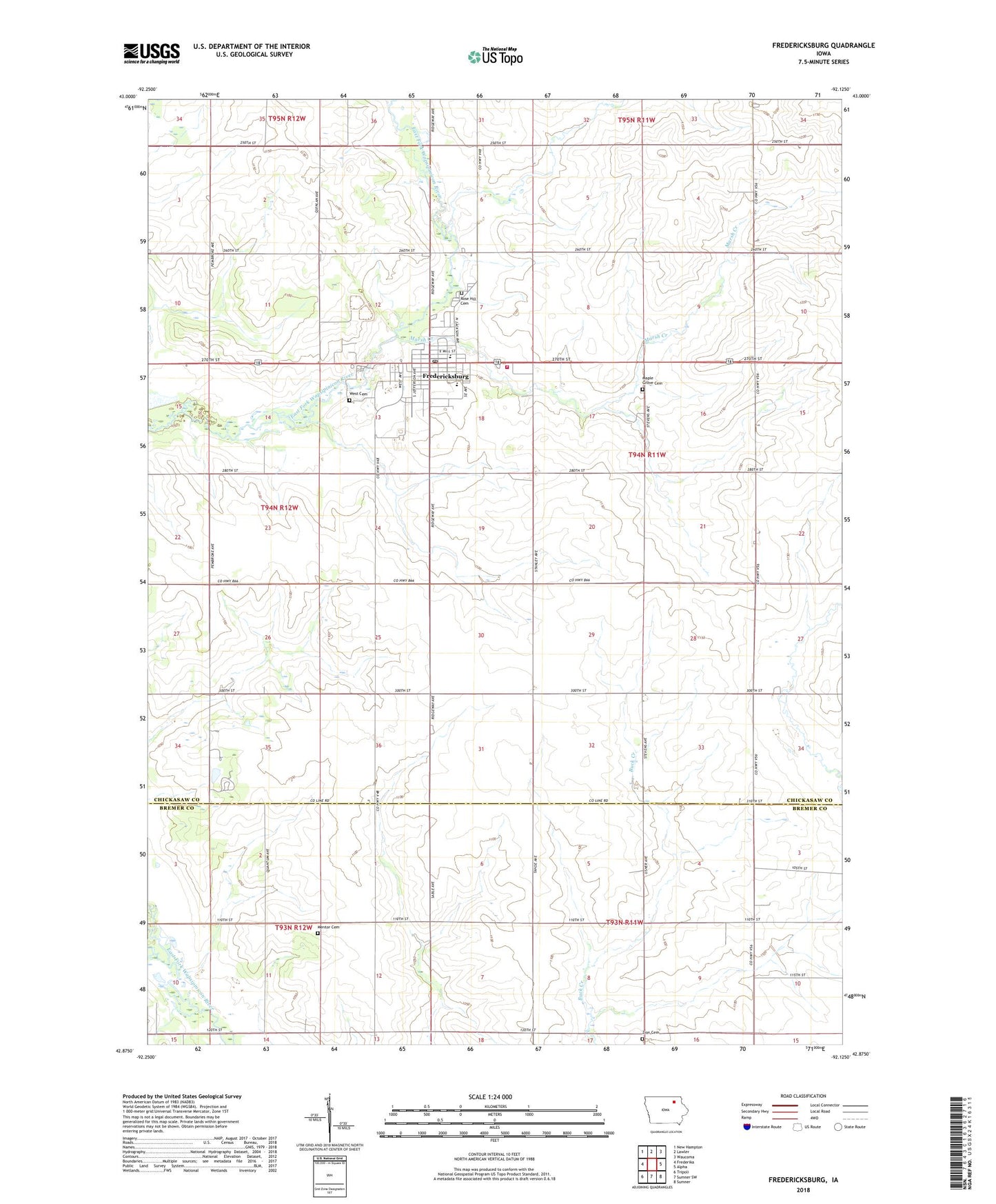
2022 topographic map quadrangle Fredericksburg in the state of Iowa. Scale: 1:24000. Based on the newly updated USGS 7.5' US Topo map series, this map is in the following counties: Chickasaw, Bremer. The map contains contour data, water features, and other items you are used to seeing on USGS maps, but also has updated roads and other features. This is the next generation of topographic maps. Printed on high-quality waterproof paper with UV fade-resistant inks.
Quads adjacent to this one:
West: Frederika
Northwest: New Hampton
North: Lawler
Northeast: Waucoma
East: Alpha
Southeast: Sumner
South: Sumner SW
Southwest: Tripoli
This map covers the same area as the classic USGS quad with code o42092h2.
Contains the following named places: Chickasaw Ambulance Fredericksburg, Church of the Brethren, City of Fredericksburg, Countryside Chiropractic Clinic, Fredericksburg, Fredericksburg Elementary School, Fredericksburg Family Health Center, Fredericksburg Farmers Co-op Elevator, Fredericksburg Fire Department, Fredericksburg Municipal Hall, Fredericksburg Post Office, Fredericksburg Wildlife Area, Hawkeye Buffalo Ranch, Hillcrest Baptist Church, Klotz Landing Field, Maple Grove Cemetery, Marsh Creek, McFarland Hereford Farm Landing Strip, Mentor Cemetery, Mentor Post Office, Peace United Church of Christ, Plum Creek Country Club, Rose Hill Cemetery, Saint Fredericks Catholic Church, Saint Pauls Lutheran Church, Split Rock County Park, Split Rock Lake, Split Rock Lake Dam, Sumner - Fredericksburg Middle School, Sunrise Guest Home, Township of Fredericksburg, Upham Memorial Library, West Cemetery, Zion Cemetery, ZIP Code: 50630