MyTopo
Fairbank Iowa US Topo Map
Couldn't load pickup availability
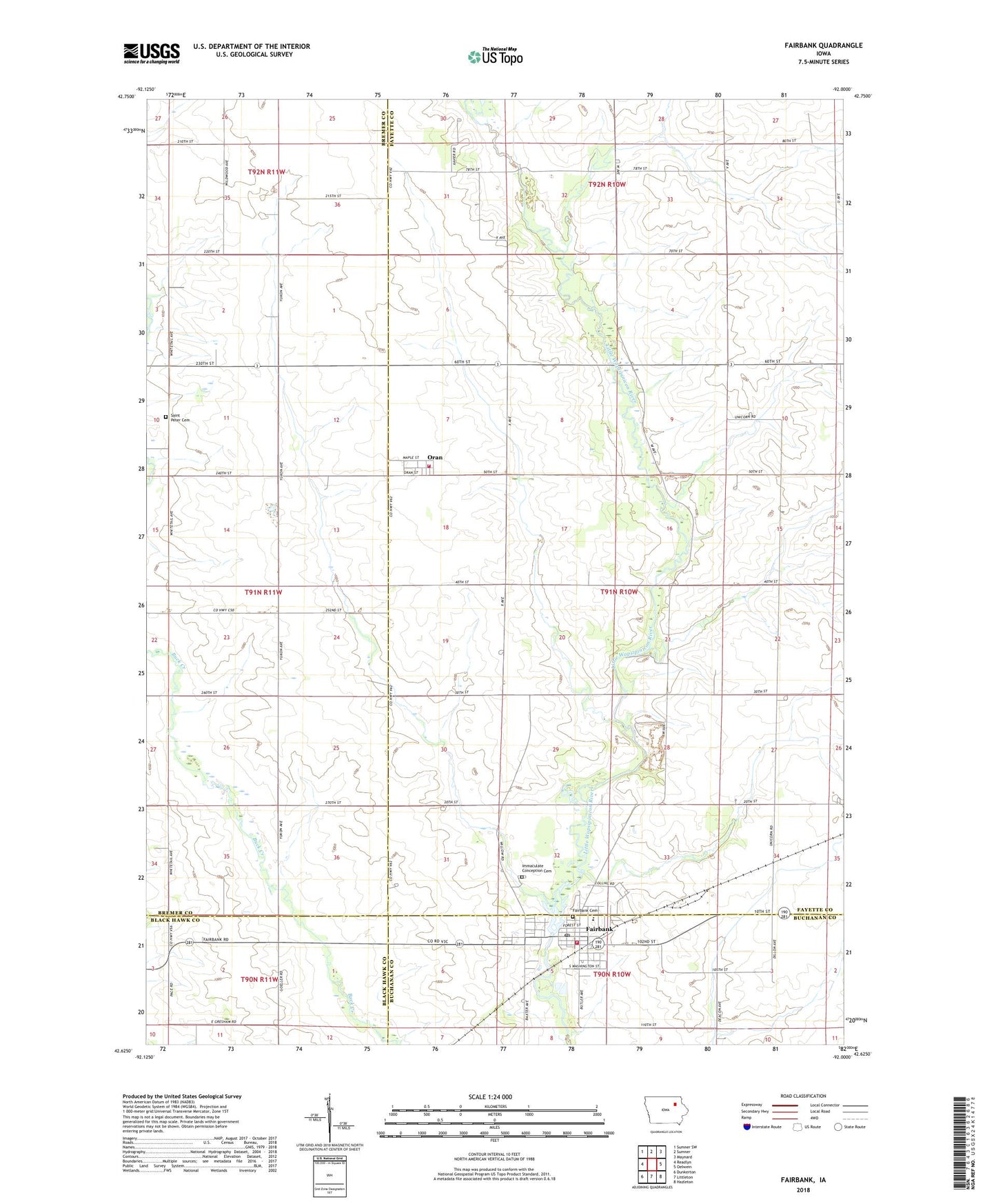
2022 topographic map quadrangle Fairbank in the state of Iowa. Scale: 1:24000. Based on the newly updated USGS 7.5' US Topo map series, this map is in the following counties: Fayette, Bremer, Buchanan, Black Hawk. The map contains contour data, water features, and other items you are used to seeing on USGS maps, but also has updated roads and other features. This is the next generation of topographic maps. Printed on high-quality waterproof paper with UV fade-resistant inks.
Quads adjacent to this one:
West: Readlyn
Northwest: Sumner SW
North: Sumner
Northeast: Maynard
East: Oelwein
Southeast: Hazleton
South: Littleton
Southwest: Dunkerton
This map covers the same area as the classic USGS quad with code o42092f1.
Contains the following named places: City of Fairbank, Downing County Park, Fairbank, Fairbank Cemetery, Fairbank Fire Department, Fairbank Post Office, Fairbank Public Library, Immaculate Conception Catholic Church, Immaculate Conception Cemetery, Lord of the Harvest Lutheran Church, Miner, Oran, Oran Fire Department and First Responders, Penn, Penn Post Office, Saint John's Lutheran Church, Saint Peter Evangelical Lutheran Cemetery, Saint Peter Lutheran Church, Siggelkov Park, Township of Oran, United Methodist Church, Wapsie Valley Fairbank Elementary School, Wapsie Valley High School, Wapsie Valley Junior High School, ZIP Codes: 50629, 50664