MyTopo
Tabor SW Iowa US Topo Map
Couldn't load pickup availability
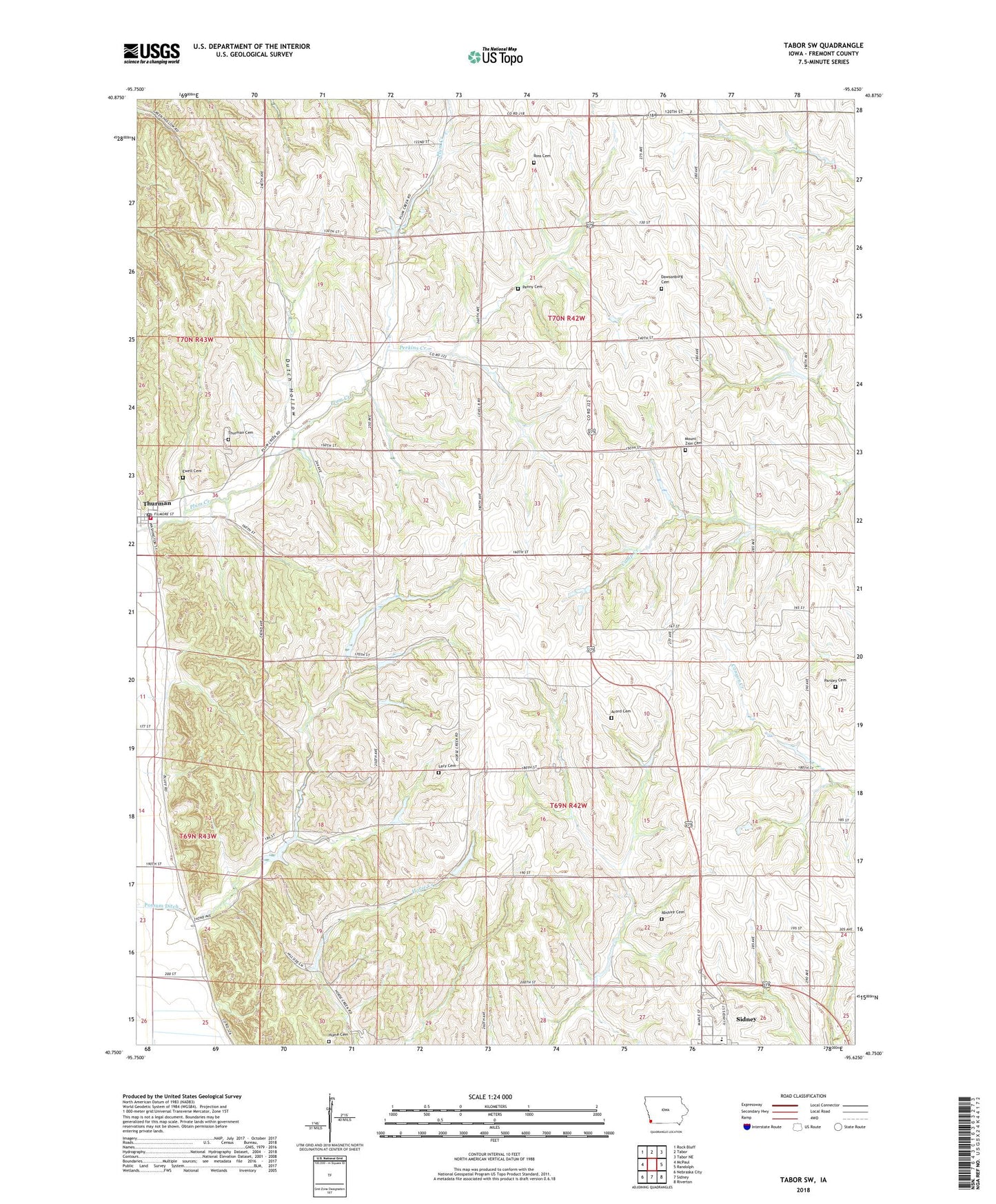
2022 topographic map quadrangle Tabor SW in the state of Iowa. Scale: 1:24000. Based on the newly updated USGS 7.5' US Topo map series, this map is in the following counties: Fremont. The map contains contour data, water features, and other items you are used to seeing on USGS maps, but also has updated roads and other features. This is the next generation of topographic maps. Printed on high-quality waterproof paper with UV fade-resistant inks.
Quads adjacent to this one:
West: McPaul
Northwest: Rock Bluff
North: Tabor
Northeast: Tabor NE
East: Randolph
Southeast: Riverton
South: Sidney
Southwest: Nebraska City
This map covers the same area as the classic USGS quad with code o40095g6.
Contains the following named places: Abshire Cemetery, Acord Cemetery, City of Thurman, Dawsonburg, Dawsonburg Cemetery, Dawsonburg Post Office, Dutch Hollow, Ewell Cemetery, Green Hollow Wildlife Management Area, Hume Cemetery, Lacy Cemetery, Loess Hills Landing, Mount Zion Cemetery, Mount Zion Church, Parsley Cemetery, Penny Cemetery, Perkins Creek, Ross Cemetery, Sidney Elementary School, Thurman, Thurman Cemetery, Thurman Fire and Rescue Department, Thurman Post Office, Township of Green