MyTopo
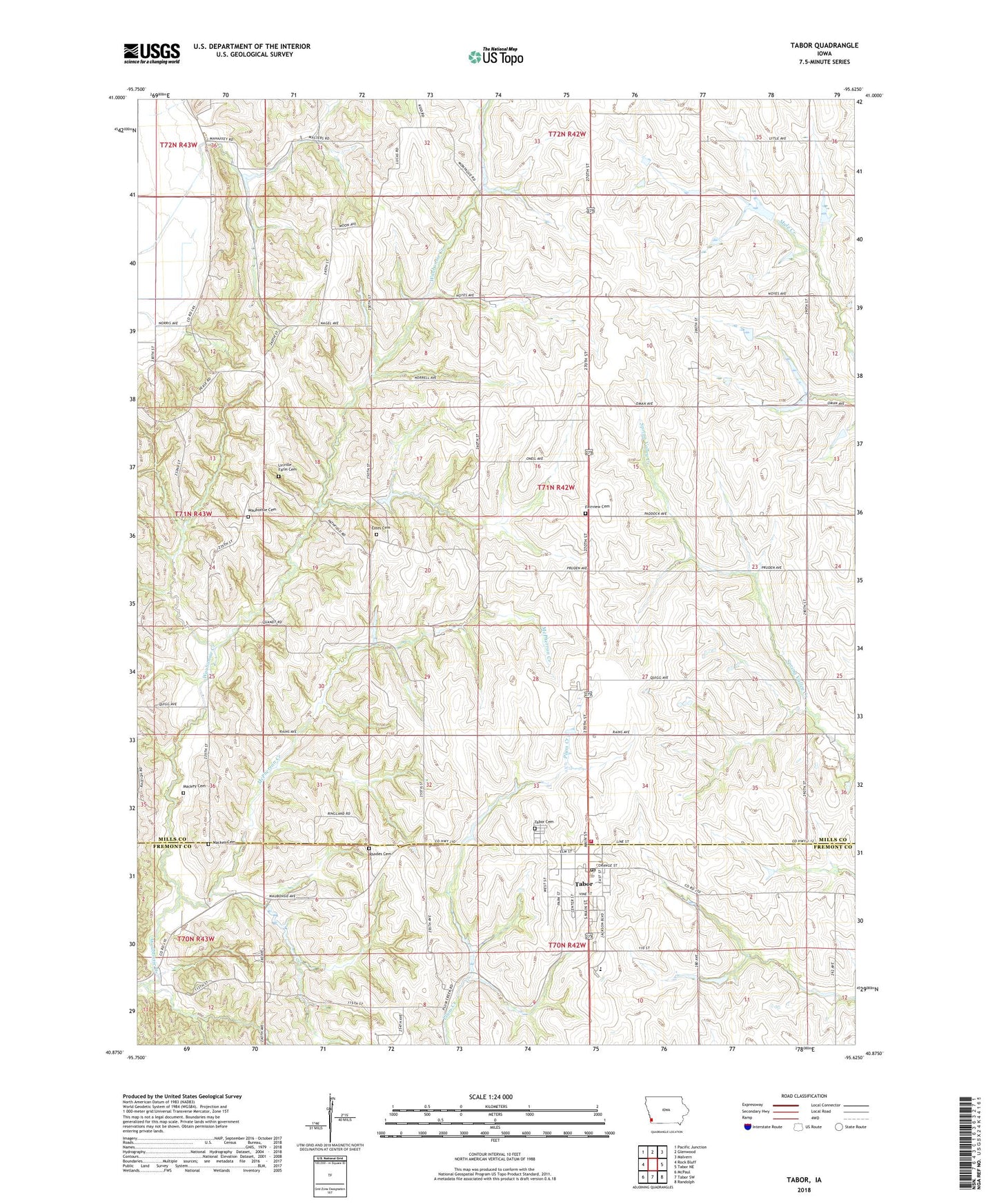
Tabor Iowa US Topo Map
Couldn't load pickup availability
2022 topographic map quadrangle Tabor in the state of Iowa. Scale: 1:24000. Based on the newly updated USGS 7.5' US Topo map series, this map is in the following counties: Mills, Fremont. The map contains contour data, water features, and other items you are used to seeing on USGS maps, but also has updated roads and other features. This is the next generation of topographic maps. Printed on high-quality waterproof paper with UV fade-resistant inks.
Quads adjacent to this one:
West: Rock Bluff
Northwest: Pacific Junction
North: Glenwood
Northeast: Malvern
East: Tabor NE
Southeast: Randolph
South: Tabor SW
Southwest: McPaul
This map covers the same area as the classic USGS quad with code o40095h6.
Contains the following named places: City of Tabor, Congregational United Church of Christ, Elm Grove School, Estes Cemetery, Estes School, Fairview Cemetery, First Christian Church, Four Corners School, Fremont - Mills Elementary School, Fremont - Mills Junior / Senior High School, Grave of Chief Waubonsie Historical Marker, Linville Farm Cemetery, Mackey Cemetery, McPherron Creek, Medical Clinic, Pinky's Glen, Pleasant Ridge School, Reorganized Church of Jesus Christ of Latter Day Saints, Rhodes Cemetery, Shady Grove School, Tabor, Tabor Cemetery, Tabor City Park, Tabor College, Tabor Manor Care Center, Tabor Post Office, Tabor Public Library, Tabor Volunteer Emergency Medical Service, Tabor Volunteer Fire Department - Mills Fremont Rural Fire Protective Association, Township of Rawles, United Methodist Church, Wahaghbonsy, Wahaghbonsy Post Office, Waubonsie Bible Church, Waubonsie Cemetery, ZIP Code: 51653