MyTopo
Alta Vista SE Kansas US Topo Map
Couldn't load pickup availability
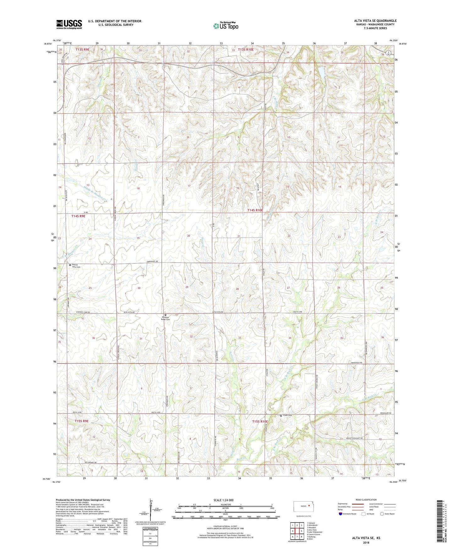
2022 topographic map quadrangle Alta Vista SE in the state of Kansas. Scale: 1:24000. Based on the newly updated USGS 7.5' US Topo map series, this map is in the following counties: Wabaunsee. The map contains contour data, water features, and other items you are used to seeing on USGS maps, but also has updated roads and other features. This is the next generation of topographic maps. Printed on high-quality waterproof paper with UV fade-resistant inks.
Quads adjacent to this one:
West: Alta Vista
Northwest: Volland
North: Allendorph
Northeast: Hessdale
East: Lake Wabaunsee
Southeast: Allen
South: Bushong
Southwest: Council Grove
This map covers the same area as the classic USGS quad with code o38096g3.
Contains the following named places: Chalk, Chalk Cemetery, East Branch Rock Creek, Emmanuel United Methodist Church, Pleasant Ridge Cemetery, Prairie View Cemetery, Township of Rock Creek, West Branch Rock Creek