MyTopo
Council Grove Kansas US Topo Map
Couldn't load pickup availability
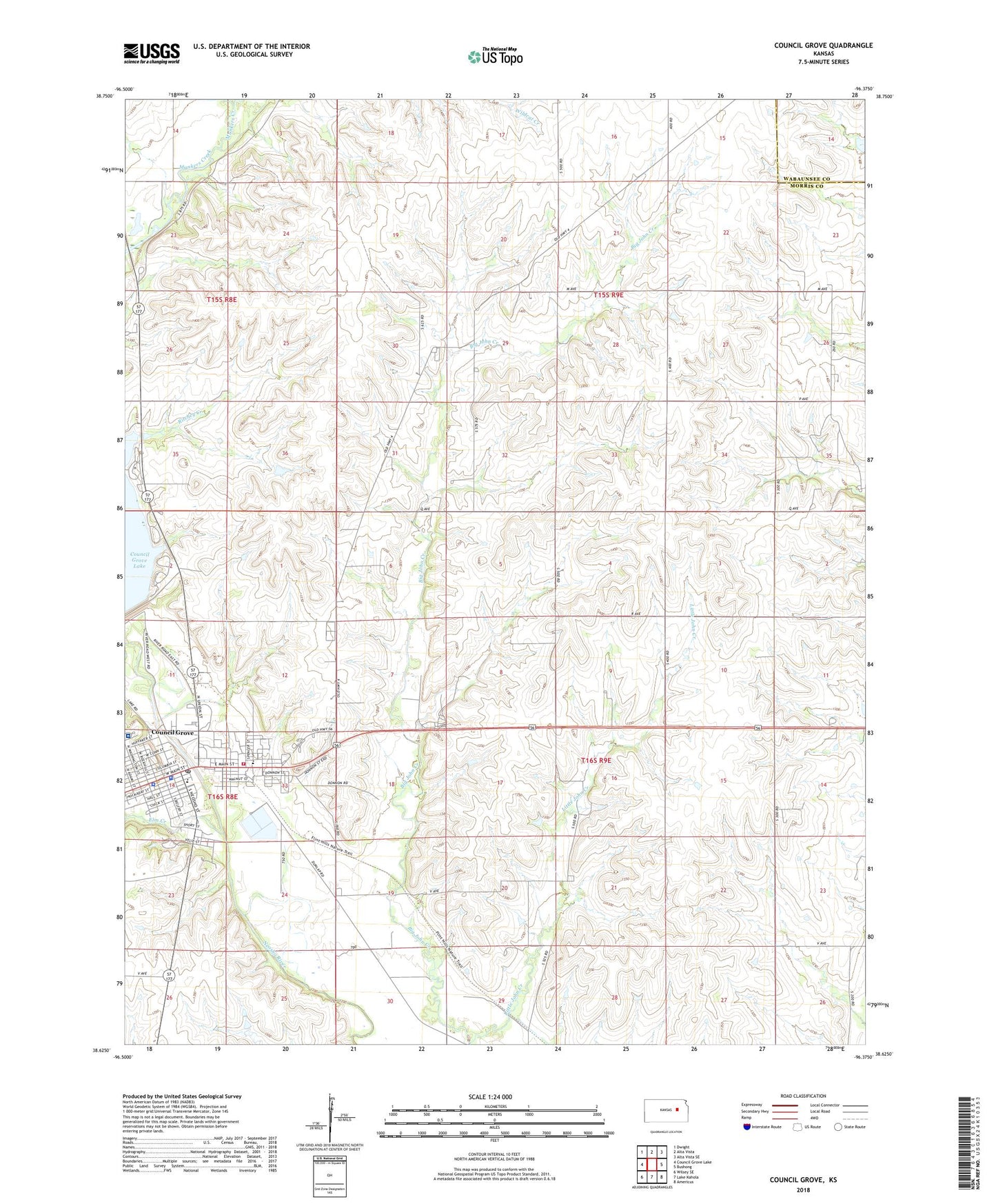
2022 topographic map quadrangle Council Grove in the state of Kansas. Scale: 1:24000. Based on the newly updated USGS 7.5' US Topo map series, this map is in the following counties: Morris, Wabaunsee. The map contains contour data, water features, and other items you are used to seeing on USGS maps, but also has updated roads and other features. This is the next generation of topographic maps. Printed on high-quality waterproof paper with UV fade-resistant inks.
Quads adjacent to this one:
West: Council Grove Lake
Northwest: Dwight
North: Alta Vista
Northeast: Alta Vista SE
East: Bushong
Southeast: Americus
South: Lake Kahola
Southwest: Wilsey SE
This map covers the same area as the classic USGS quad with code o38096f4.
Contains the following named places: Alexander Ranch Airport, Berean Baptist Church, Calvary Lutheran Church, City of Council Grove, Council Grove, Council Grove Christian Church, Council Grove Elementary School, Council Grove Fire Department, Council Grove Junior / Senior High School, Council Grove Police Department, Council Grove Post Office, Council Grove Public Library, Council Grove Sewer Treatment Plant, Council Grove United Methodist Church, Elm Creek, First Congregational United Church of Christ, Flint Hills Apostolic Church, Garfield Elementary School, John Creek Oil Field, Kaw Mission, Little John Creek, Morris County Courthouse, Morris County Fairgrounds, Morris County Health Department, Morris County Hospital, Morris County Senior Center, Morris County Sheriff's Office, Pioneer Mobile Home Village, Post Office Oak and Museum, Richey Cove South Recreation Area, Rolland Mark - Mark Grain Company Grain Elevator Number 1, Saint Rose of Lima Catholic Church, Township 2, Trail Days Museum, Washington Elementary School, ZIP Code: 66846