MyTopo
Alta Vista Kansas US Topo Map
Couldn't load pickup availability
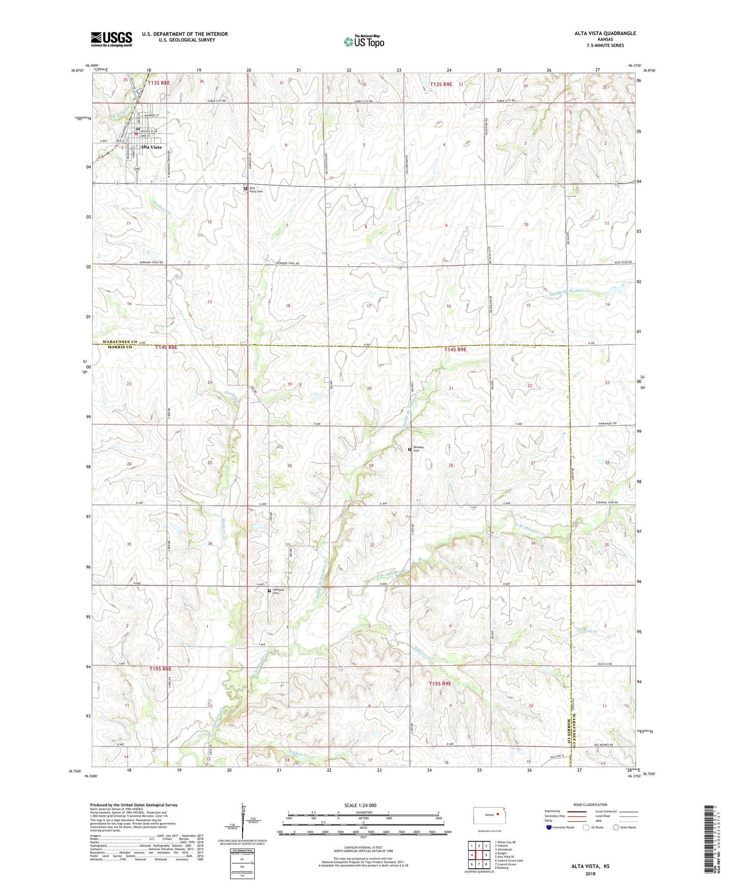
2022 topographic map quadrangle Alta Vista in the state of Kansas. Scale: 1:24000. Based on the newly updated USGS 7.5' US Topo map series, this map is in the following counties: Morris, Wabaunsee. The map contains contour data, water features, and other items you are used to seeing on USGS maps, but also has updated roads and other features. This is the next generation of topographic maps. Printed on high-quality waterproof paper with UV fade-resistant inks.
Quads adjacent to this one:
West: Dwight
Northwest: White City NE
North: Volland
Northeast: Allendorph
East: Alta Vista SE
Southeast: Bushong
South: Council Grove
Southwest: Council Grove Lake
This map covers the same area as the classic USGS quad with code o38096g4.
Contains the following named places: Alta Vista, Alta Vista Cemetery, Alta Vista Post Office, Alta Vista United Metrhodist Church, Alta Vista Wastewater Plant, Beman, Beman Cemetery, City of Alta Vista, East Branch Munkers Creek, Elkhorn Creek, Farmers Co - Operative Association Grain Elevator Number 2, First Baptist Church, Garfield Cemetery, Middle Branch Munkers Creek, Pike, Pottawatomie Wabaunsee Regional Library Alta Vista Mini Branch, Prairie Heights Elementary School, Saint Paul's Lutheran Church, Township of Garfield, Wabaunsee County Fire District 2 Alta Vista Fire Department, Wildcat Creek, ZIP Code: 66834