MyTopo
Argonia Kansas US Topo Map
Couldn't load pickup availability
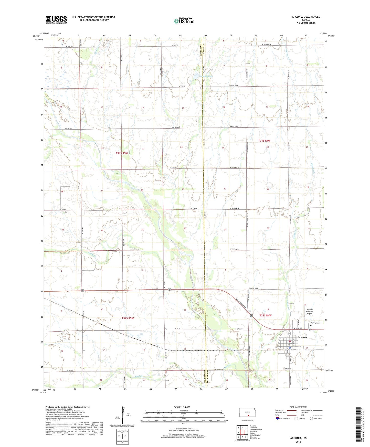
2022 topographic map quadrangle Argonia in the state of Kansas. Scale: 1:24000. Based on the newly updated USGS 7.5' US Topo map series, this map is in the following counties: Harper, Sumner. The map contains contour data, water features, and other items you are used to seeing on USGS maps, but also has updated roads and other features. This is the next generation of topographic maps. Printed on high-quality waterproof paper with UV fade-resistant inks.
Quads adjacent to this one:
West: Danville
Northwest: Adams
North: Norwich
Northeast: Conway Springs
East: Milan
Southeast: Caldwell NW
South: Freeport
Southwest: Bluff City NW
This map covers the same area as the classic USGS quad with code o37097c7.
Contains the following named places: Albion, Argonia, Argonia Bible Church, Argonia Cemetery, Argonia City Hall, Argonia Community Center, Argonia Elementary School, Argonia Emergency Medical Services, Argonia Fire Department, Argonia Friends Church, Argonia Junior / Senior High School, Argonia Municipal Airport, Argonia Police Department, Argonia Post Office, Argonia United Methodist Church, City of Argonia, Dixon Township Fire District, Dixon Township Library, First Baptist Church, Floyd Memorial Chapel, Paradise Lake, Plains Church, Salter House and Museum, Sand Creek, Sandy Creek, Spring Creek, Zion Lutheran Church, ZIP Code: 67004