MyTopo
Norwich Kansas US Topo Map
Couldn't load pickup availability
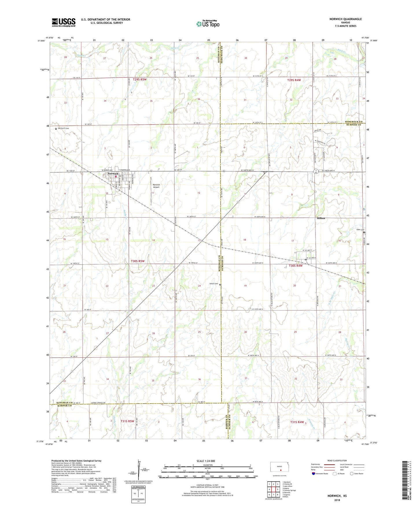
2022 topographic map quadrangle Norwich in the state of Kansas. Scale: 1:24000. Based on the newly updated USGS 7.5' US Topo map series, this map is in the following counties: Kingman, Sumner, Sedgwick, Harper. The map contains contour data, water features, and other items you are used to seeing on USGS maps, but also has updated roads and other features. This is the next generation of topographic maps. Printed on high-quality waterproof paper with UV fade-resistant inks.
Quads adjacent to this one:
West: Adams
Northwest: Murdock
North: Cheney SE
Northeast: Lake Afton
East: Conway Springs
Southeast: Milan
South: Argonia
Southwest: Danville
This map covers the same area as the classic USGS quad with code o37097d7.
Contains the following named places: City of Norwich, Dotzour Senior Center, Eden Cemetery, First Baptist Church, Judson School, Milton, Milton Baptist Church, Milton Census Designated Place, Milton Post Office, Milton United Methodist Church, Norwich, Norwich Airport, Norwich Christian Church, Norwich Church of Christ, Norwich City Hall, Norwich Community Library, Norwich Elementary School, Norwich High School, Norwich Middle School, Norwich Police Department, Norwich United Methodist Church, Norwich Volunteer Fire Department, Norwich Wastewater Plant, Stitch Cemetery, Suppesville, Suppesville Golf Course, Suppesville Wastewater Plant, Township of Bennett, Township of Eden, Upchurch Cemetery, ZIP Codes: 67106, 67118