MyTopo
Conway Springs Kansas US Topo Map
Couldn't load pickup availability
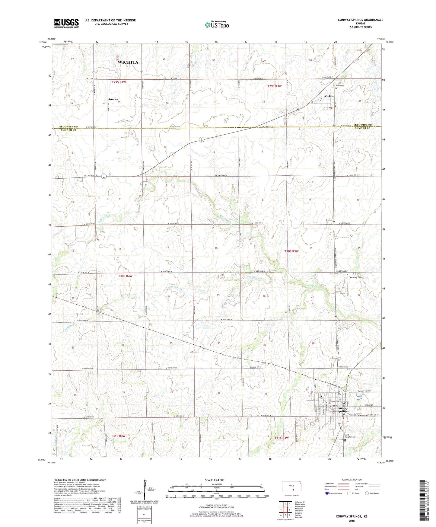
2022 topographic map quadrangle Conway Springs in the state of Kansas. Scale: 1:24000. Based on the newly updated USGS 7.5' US Topo map series, this map is in the following counties: Sumner, Sedgwick. The map contains contour data, water features, and other items you are used to seeing on USGS maps, but also has updated roads and other features. This is the next generation of topographic maps. Printed on high-quality waterproof paper with UV fade-resistant inks.
Quads adjacent to this one:
West: Norwich
Northwest: Cheney SE
North: Lake Afton
Northeast: Clearwater
East: Millerton
Southeast: Mayfield
South: Milan
Southwest: Argonia
This map covers the same area as the classic USGS quad with code o37097d6.
Contains the following named places: Anness, City of Conway Springs, City of Viola, Conway Springs, Conway Springs City Hall, Conway Springs Fire Department, Conway Springs High School, Conway Springs Middle School, Conway Springs Museum, Conway Springs Police Department, Conway Springs Post Office, Conway Springs United Methodist Church, Conway Springs Volunteer Emergency Medical Services, Conway Springs Wastewater Treatment Plant, Conway Springs Water Tower, First Baptist Church, Kalamazoo, Kyle Trueblood Elementary School, North Branch State Creek, Saint Joseph Catholic Church, Saint Joseph Catholic School, Saint Josephs Cemetery, South Branch Slate Creek, Sunset, Township of Conway, Viola, Viola Baptist Church, Viola Cemetery, Viola Fire Station 65, Viola Post Office, Viola Presbyterian Church, Viola Township Library, Viola Wastewater Treatment Facility, Wamsley Field, ZIP Code: 67031