MyTopo
Arlington Kansas US Topo Map
Couldn't load pickup availability
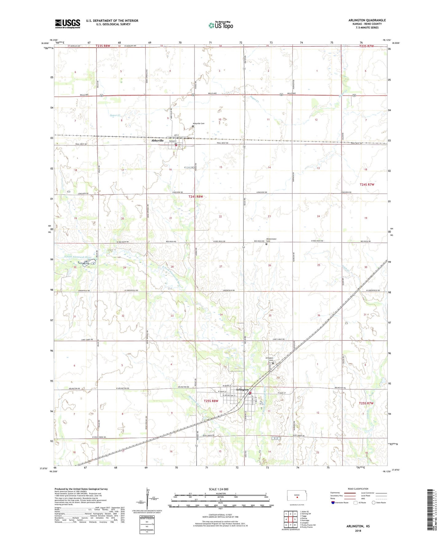
2022 topographic map quadrangle Arlington in the state of Kansas. Scale: 1:24000. Based on the newly updated USGS 7.5' US Topo map series, this map is in the following counties: Reno. The map contains contour data, water features, and other items you are used to seeing on USGS maps, but also has updated roads and other features. This is the next generation of topographic maps. Printed on high-quality waterproof paper with UV fade-resistant inks.
Quads adjacent to this one:
West: Plevna
Northwest: Alden SE
North: Sterling SW
Northeast: Yaggy
East: Partridge
Southeast: Pretty Prairie
South: Pretty Prairie SW
Southwest: Langdon
This map covers the same area as the classic USGS quad with code o37098h2.
Contains the following named places: Abbyville, Abbyville Cemetery, Abbyville Post Office, Abbyville Wastewater Plant, Arlington, Arlington Cemetery, Arlington City Hall, Arlington City Library, Arlington Mennonite Church, Arlington Post Office, Arlington United Methodist Church, Arlington United Presbyterian Church, Arlington Wastewater Treatment Facility, Baughman Field, Camp Kanza, City of Abbyville, City of Arlington, Fairfield East Elementary School, Lake Cable, Reno County Fire District 4 Station 1, Reno County Fire District 4 Station 2, Skinnawah Creek, Township of Westminster, Westminster Cemetery