MyTopo
Yaggy Kansas US Topo Map
Couldn't load pickup availability
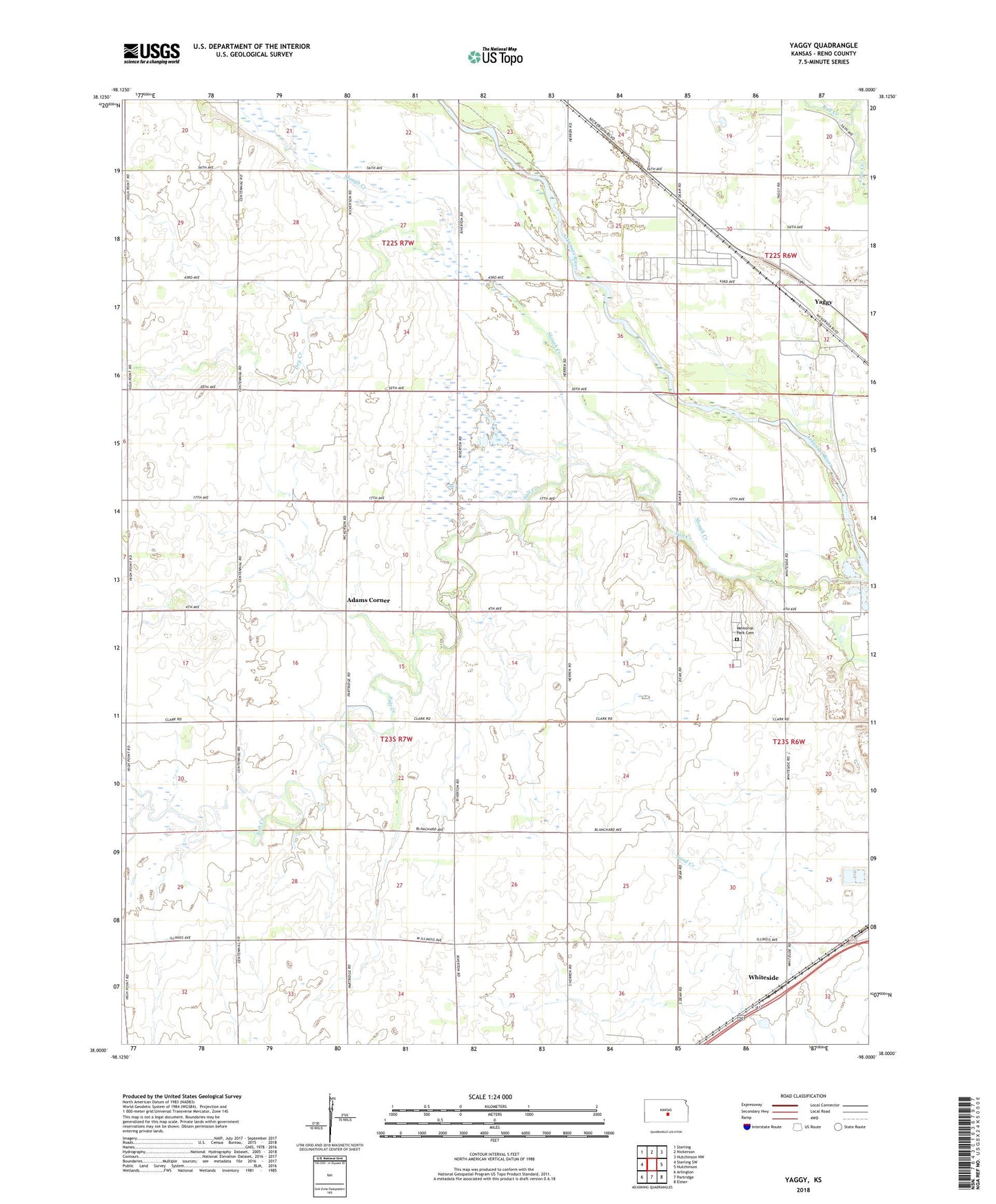
2022 topographic map quadrangle Yaggy in the state of Kansas. Scale: 1:24000. Based on the newly updated USGS 7.5' US Topo map series, this map is in the following counties: Reno. The map contains contour data, water features, and other items you are used to seeing on USGS maps, but also has updated roads and other features. This is the next generation of topographic maps. Printed on high-quality waterproof paper with UV fade-resistant inks.
Quads adjacent to this one:
West: Sterling SW
Northwest: Sterling
North: Nickerson
Northeast: Hutchinson NW
East: Hutchinson
Southeast: Elmer
South: Partridge
Southwest: Arlington
This map covers the same area as the classic USGS quad with code o38098a1.
Contains the following named places: Adams Corner, Bull Creek, Centennial School, Dry Creek, KHUT-FM (Hutchinson), Memorial Park Cemetery, Poplar School, Slough Creek, Sugar Creek, Team Marketing Alliance Grain Elevator Number 36, Township of Salt Creek, Western Acres Mobile Home Park, Whiteside, Yaggy, ZIP Code: 67561