MyTopo
Partridge Kansas US Topo Map
Couldn't load pickup availability
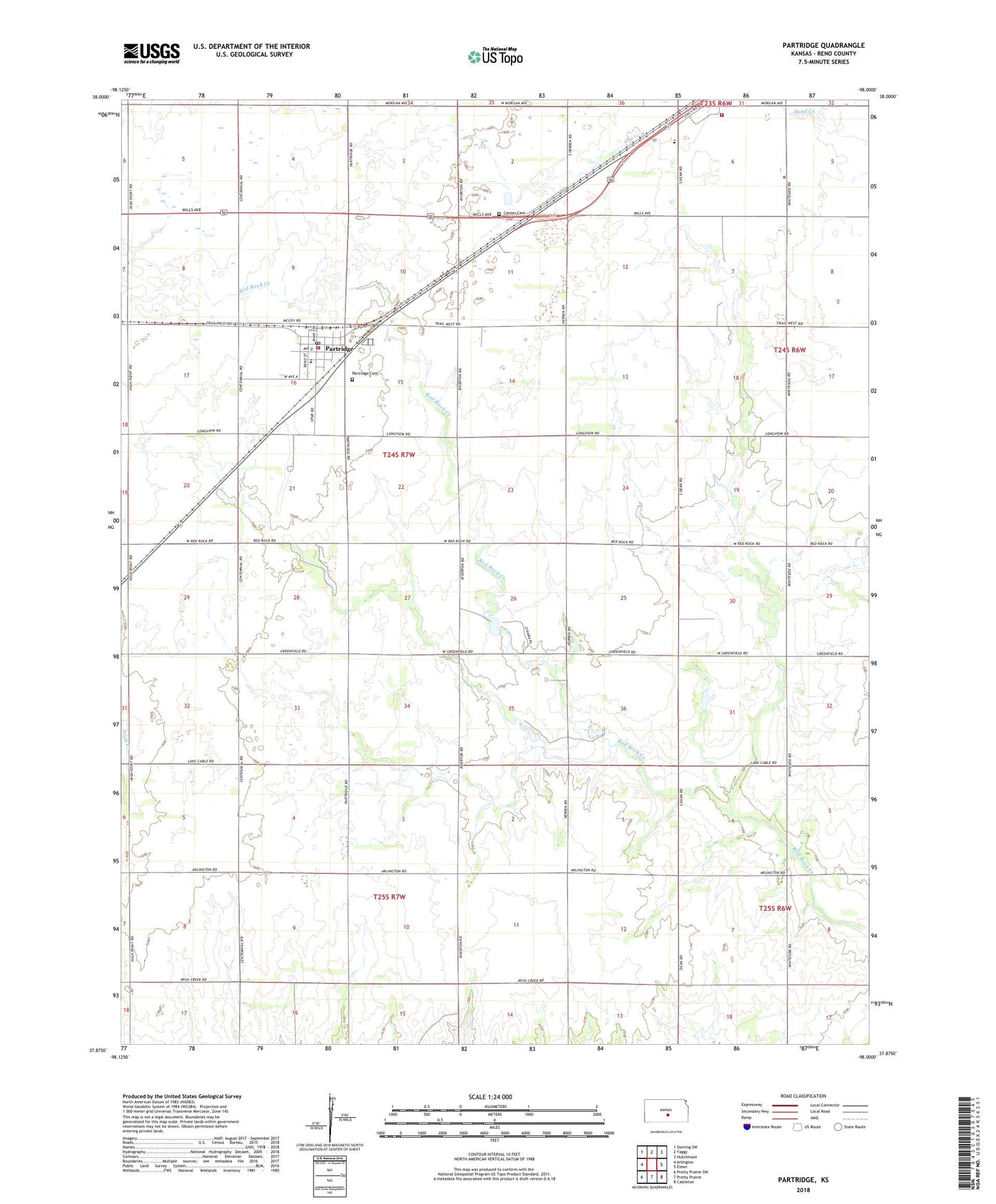
2022 topographic map quadrangle Partridge in the state of Kansas. Scale: 1:24000. Based on the newly updated USGS 7.5' US Topo map series, this map is in the following counties: Reno. The map contains contour data, water features, and other items you are used to seeing on USGS maps, but also has updated roads and other features. This is the next generation of topographic maps. Printed on high-quality waterproof paper with UV fade-resistant inks.
Quads adjacent to this one:
West: Arlington
Northwest: Sterling SW
North: Yaggy
Northeast: Hutchinson
East: Elmer
Southeast: Castleton
South: Pretty Prairie
Southwest: Pretty Prairie SW
This map covers the same area as the classic USGS quad with code o37098h1.
Contains the following named places: Center Amish Mennonite Church, City of Partridge, Kansas State University Experimental Farm, Partridge, Partridge Cemetery, Partridge Community Church, Partridge Grade School, Partridge Post Office, Partridge Public Library, Partridge Wastewater Treatment Facility, Plainview Mennonite Church, Pleasantview Academy Grade School, Pleasantview Academy High School, Reno County, Reno County Fire District 4 Station 4, Reno County Fire District 8 Station 2, Riverton, Team Marketing Alliance Grain Elevator Number 31, Township of Center, West Center Cemetery, ZIP Code: 67566