MyTopo
Ash Grove Kansas US Topo Map
Couldn't load pickup availability
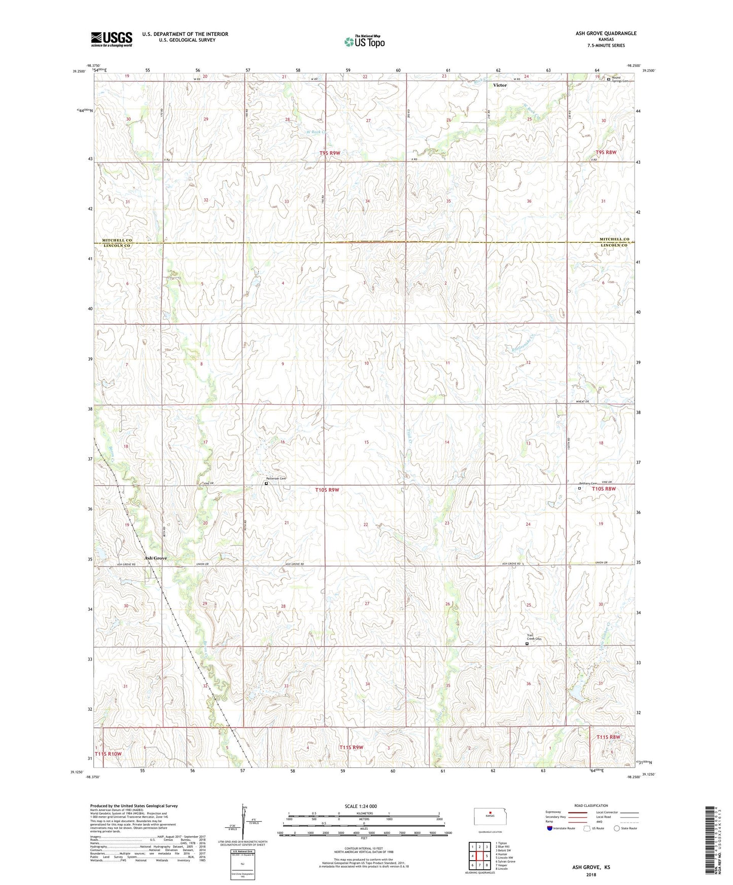
2022 topographic map quadrangle Ash Grove in the state of Kansas. Scale: 1:24000. Based on the newly updated USGS 7.5' US Topo map series, this map is in the following counties: Lincoln, Mitchell. The map contains contour data, water features, and other items you are used to seeing on USGS maps, but also has updated roads and other features. This is the next generation of topographic maps. Printed on high-quality waterproof paper with UV fade-resistant inks.
Quads adjacent to this one:
West: Hunter
Northwest: Tipton
North: Blue Hill
Northeast: Beloit SW
East: Lincoln NW
Southeast: Lincoln
South: Vesper
Southwest: Sylvan Grove
This map covers the same area as the classic USGS quad with code o39098b3.
Contains the following named places: Ash Grove, Ash Grove United Methodist Church, Bayne, Bethany Baptist Cemetery, Bethany Baptist Church, Patterson Cemetery, Round Springs Cemetery, Round Springs Church, Township of Orange, Trail Creek Cemetery, Victor, Walker School, West Rock Creek, Yorktown, ZIP Code: 67452