MyTopo
Axtell Kansas US Topo Map
Couldn't load pickup availability
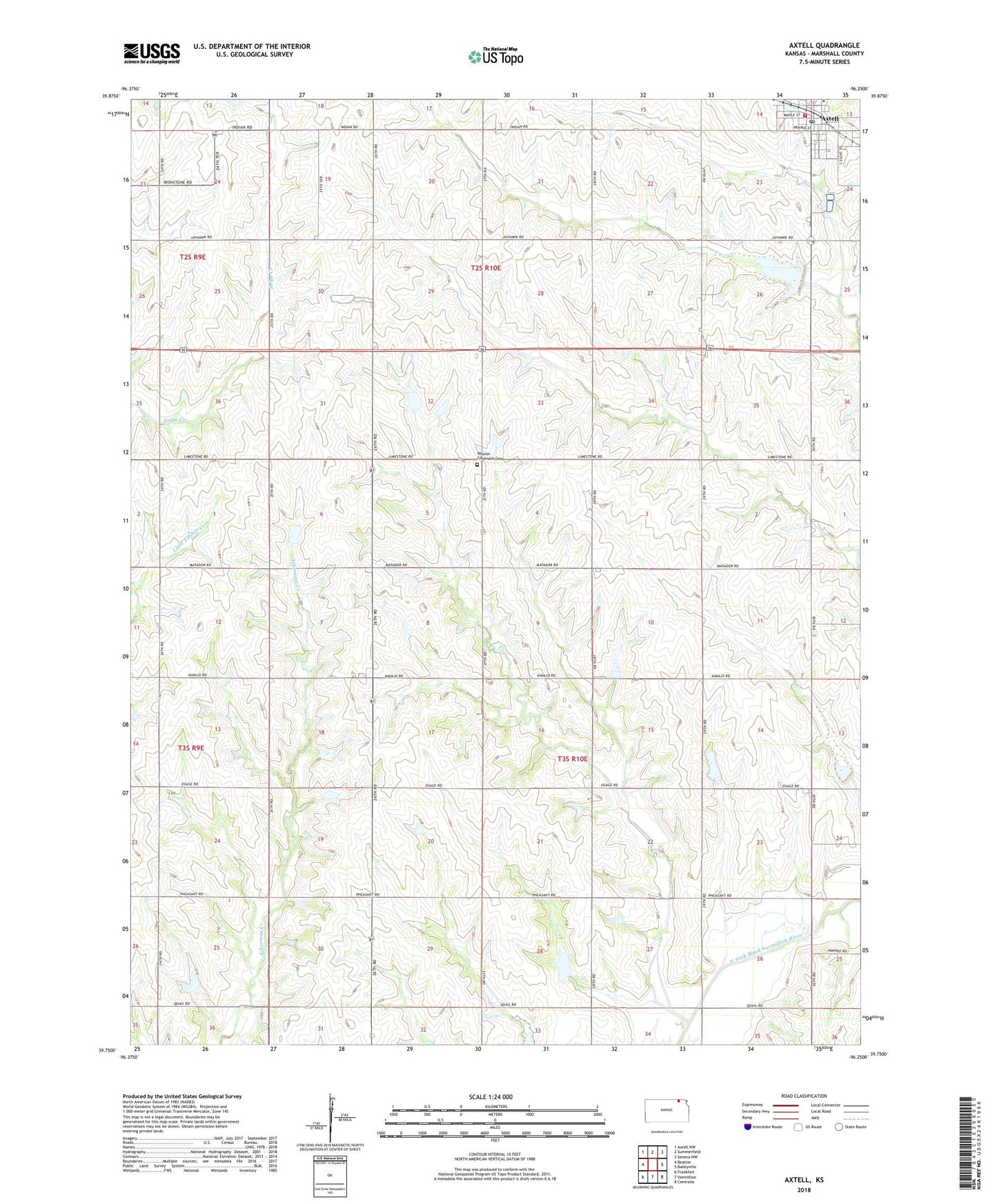
2022 topographic map quadrangle Axtell in the state of Kansas. Scale: 1:24000. Based on the newly updated USGS 7.5' US Topo map series, this map is in the following counties: Marshall. The map contains contour data, water features, and other items you are used to seeing on USGS maps, but also has updated roads and other features. This is the next generation of topographic maps. Printed on high-quality waterproof paper with UV fade-resistant inks.
Quads adjacent to this one:
West: Beattie
Northwest: Axtell NW
North: Summerfield
Northeast: Seneca NW
East: Baileyville
Southeast: Centralia
South: Vermillion
Southwest: Frankfort
This map covers the same area as the classic USGS quad with code o39096g3.
Contains the following named places: Axtell, Axtell Bern Summerfield School District Office, Axtell Community Ambulance Service, Axtell Fire Department, Axtell Grain Elevator Number 1, Axtell Post Office, Axtell Public Library, Axtell United Methodist Church, Axtell Wastewater Treatment Plant, City of Axtell, Evangelical Mission Covenant Church, Mission Covenant Cemetery, Saint Michael Catholic Church, Saint Michael Catholic Elementary School, Salem Lutheran Church, Township of Lincoln, Township of Murray