MyTopo
Beattie Kansas US Topo Map
Couldn't load pickup availability
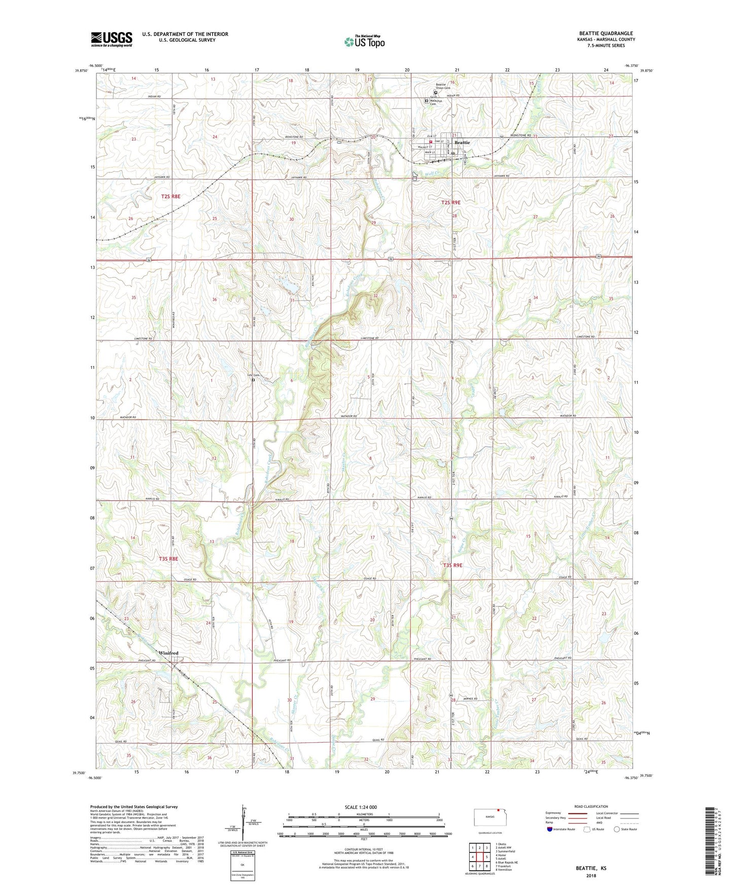
2022 topographic map quadrangle Beattie in the state of Kansas. Scale: 1:24000. Based on the newly updated USGS 7.5' US Topo map series, this map is in the following counties: Marshall. The map contains contour data, water features, and other items you are used to seeing on USGS maps, but also has updated roads and other features. This is the next generation of topographic maps. Printed on high-quality waterproof paper with UV fade-resistant inks.
Quads adjacent to this one:
West: Home
Northwest: Oketo
North: Axtell NW
Northeast: Summerfield
East: Axtell
Southeast: Vermillion
South: Frankfort
Southwest: Blue Rapids NE
This map covers the same area as the classic USGS quad with code o39096g4.
Contains the following named places: Beattie, Beattie Farmers Union Co - Operative Association Grain Elevator Number 1, Beattie Post Office, Beattie Rural Fire District 3, Beattie Union Cemetery, Beattie United Methodist Church, Beattie Wastewater Plant, City of Beattie, Dog Walk Creek, Life Cemetery, Perkins Creek, Saint Malachys Catholic Church, Saint Malachys Cemetery, Township of Guittard, Township of Rock, Winifred, Winifred Baptist Church, Winifred Feedlot, Wolf Creek, ZIP Code: 66438