MyTopo
Belle Plaine Kansas US Topo Map
Couldn't load pickup availability
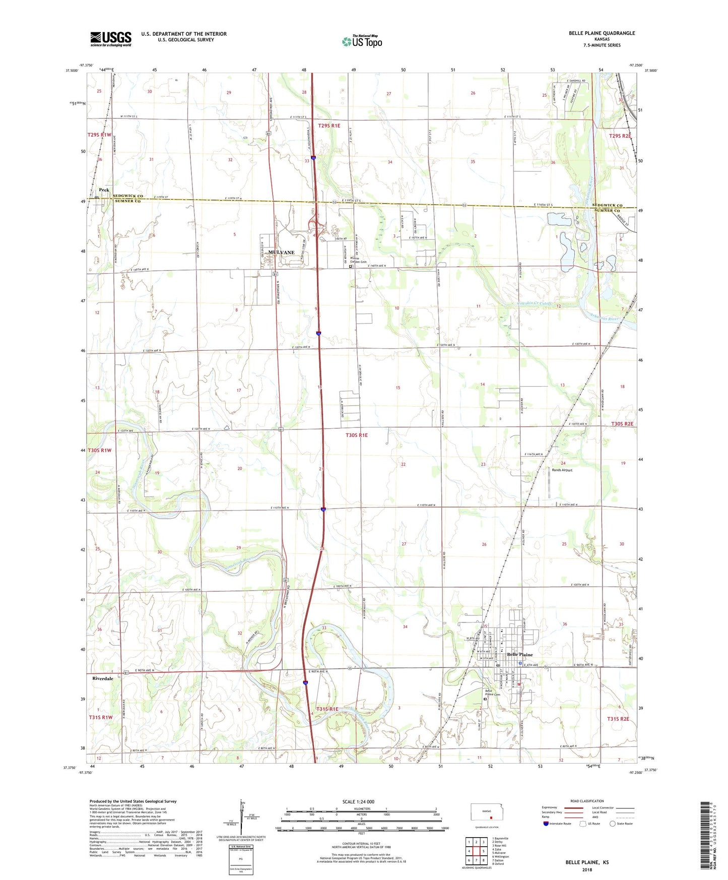
2022 topographic map quadrangle Belle Plaine in the state of Kansas. Scale: 1:24000. Based on the newly updated USGS 7.5' US Topo map series, this map is in the following counties: Sumner, Sedgwick. The map contains contour data, water features, and other items you are used to seeing on USGS maps, but also has updated roads and other features. This is the next generation of topographic maps. Printed on high-quality waterproof paper with UV fade-resistant inks.
Quads adjacent to this one:
West: Zyba
Northwest: Bayneville
North: Derby
Northeast: Rose Hill
East: Mulvane
Southeast: Oxford
South: Dalton
Southwest: Wellington
This map covers the same area as the classic USGS quad with code o37097d3.
Contains the following named places: Bartlett Arboretum, Belle Plaine, Belle Plaine Cemetery, Belle Plaine Church of Christ, Belle Plaine City Hall, Belle Plaine Elementary School, Belle Plaine Emergency Medical Services, Belle Plaine High School, Belle Plaine Middle School, Belle Plaine Police Department, Belle Plaine Post Office, Belle Plaine Presbyterian Church, Belle Plaine Public Library, Belle Plaine United Methodist Church, Belle Plaine Wastewater Treatment Plant, City of Belle Plaine, Council Hill Church, Cowskin Creek Cutoff, First Baptist Church, Kendrigan Airport, London, London School, Meekers School, Meridian School, Mulvane Wastewater Treatment Facility, New Salem School, Peck, Peck Census Designated Place, Peck Post Office, Prairie Garden Cemetery, Rands Airport, Sumner County Fire District 9 Belle Plaine, Township of Belle Plaine, Valley Mobile Home Park, ZIP Codes: 67013, 67120