MyTopo
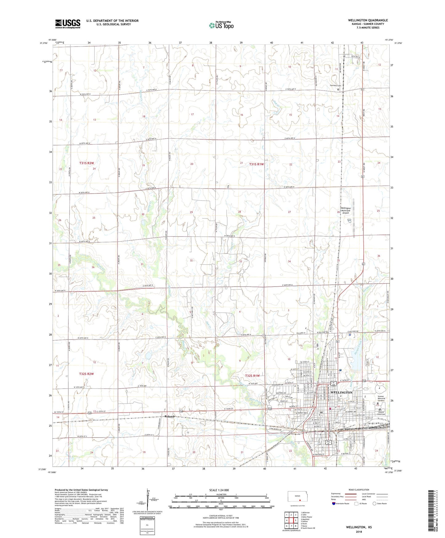
Wellington Kansas US Topo Map
Couldn't load pickup availability
2022 topographic map quadrangle Wellington in the state of Kansas. Scale: 1:24000. Based on the newly updated USGS 7.5' US Topo map series, this map is in the following counties: Sumner. The map contains contour data, water features, and other items you are used to seeing on USGS maps, but also has updated roads and other features. This is the next generation of topographic maps. Printed on high-quality waterproof paper with UV fade-resistant inks.
Quads adjacent to this one:
West: Mayfield
Northwest: Millerton
North: Zyba
Northeast: Belle Plaine
East: Dalton
Southeast: South Haven NE
South: Rome
Southwest: Perth
This map covers the same area as the classic USGS quad with code o37097c4.
Contains the following named places: Anson Southeast Oil Field, Calvary Chapel, Calvary Lutheran Church, Chisholm Trail Museum, Church of Christ, City of Wellington, Eisenhower Elementary School, Fairview Cemetery, First Assembly of God Church, First Baptist Church, First Christian Church, First Presbyterian Church, First Southern Baptist Church, First United Methodist Church, Friendly Second Baptist Church, Grace Baptist Fellowship, Heartland Community Church, Hillside Baptist Church, Immanuel Baptist Church, Jefferson School, Joy Fellowship Church, KANR - FM (Wichita), Kennedy Elementary School, Kingdom Hall of Jehovah's Witnesses, Lincoln Elementary School, Madison School, McKinley School, Memorial Auditorium and Fitness Center, Oak Creek, O'Hara Oil Field, Prairie Lawn Cemetery, Riverdale, Roland, Roosevelt Education Center, Saint Anthony's Catholic Church, Saint James African Methodist Episcopal Church, Saint John's Lutheran Church, Saint Jude's Episcopal Church, Saint Rose Catholic Church, Slate Valley School, Spring Creek, Sumner County Courthouse, Sumner County Health Department, Sumner County Sheriff's Office, Sumner Memorial Gardens, Sumner Regional Medical Center, Sumner Regional Medical Center Heliport, The Church of Jesus Christ of Latter Day Saints, Township of Seventy-Six, Township of Wellington, Tracys Mobile Home Park, Treckell Oil Field, Warden Park Speedway, Washington Elementary School, Wellington Baptist Temple, Wellington Chamber of Commerce, Wellington Christian Academy, Wellington Church of the Nazarene, Wellington City Hall, Wellington Family Aquatic Center, Wellington Fire and EMS Department, Wellington Free Will Baptist Church, Wellington Golf Club, Wellington High School, Wellington Industrial Park, Wellington Middle School, Wellington Municipal Airport, Wellington Municipal Power Plant, Wellington Northeast Oil Field, Wellington Oil Field, Wellington Police Department, Wellington Post Office, Wellington Public Library, Wellington Seventh Day Adventist Church, Woods Park, ZIP Code: 67152