MyTopo
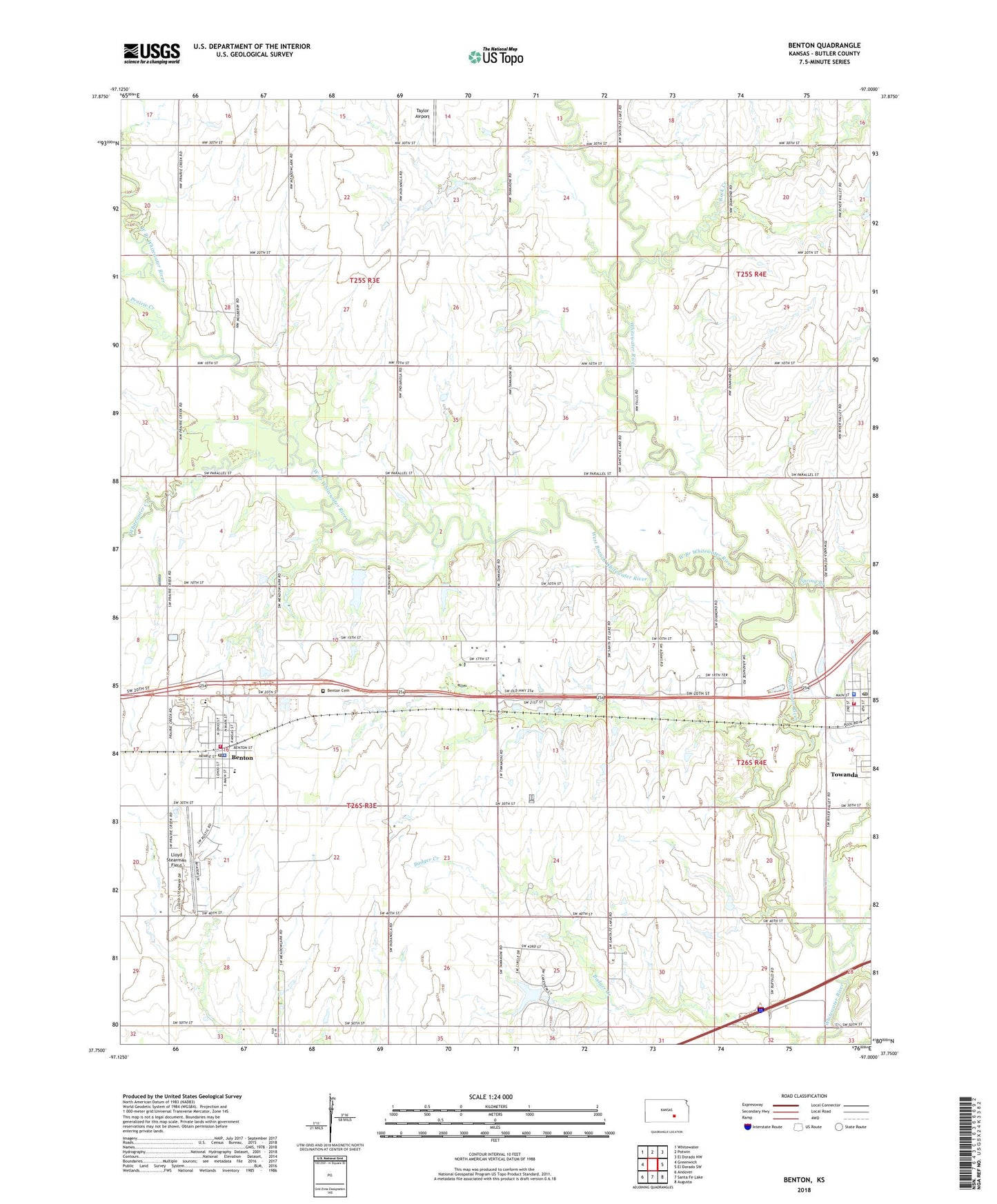
Benton Kansas US Topo Map
Couldn't load pickup availability
2022 topographic map quadrangle Benton in the state of Kansas. Scale: 1:24000. Based on the newly updated USGS 7.5' US Topo map series, this map is in the following counties: Butler. The map contains contour data, water features, and other items you are used to seeing on USGS maps, but also has updated roads and other features. This is the next generation of topographic maps. Printed on high-quality waterproof paper with UV fade-resistant inks.
Quads adjacent to this one:
West: Greenwich
Northwest: Whitewater
North: Potwin
Northeast: El Dorado NW
East: El Dorado SW
Southeast: Augusta
South: Santa Fe Lake
Southwest: Andover
This map covers the same area as the classic USGS quad with code o37097g1.
Contains the following named places: Benton, Benton Cemetery, Benton Christian Church, Benton City Hall, Benton Grade School, Benton Police Department, Benton Post Office, Benton Wastewater Treatment Facility, Butler County Fire District 7 - Benton, Circle Benton Elementary School, Circle Middle School, City of Benton, Freedom Bible Fellowship Church, Greer Miller Landing Strip, Lloyd Stearman Field, Prairie Creek, Prairie Rose Silverscreen Cowboy Museum, Rock Creek, Spring Branch, Taylor Airport, Team Marketing Alliance Grain Elevator Number 3, The Benton Church, The Museum in Towanda, Towanda City Hall, Towanda Fire Department, Towanda Police Department, Towanda Post Office, Towanda Public Library, Towanda United Methodist Church, Towanda Wastewater Treatment Facility, Township of Benton, Township of Murdock, West Branch Whitewater River, Whitewater Creek, Wildcat Creek, ZIP Codes: 67017, 67144