MyTopo
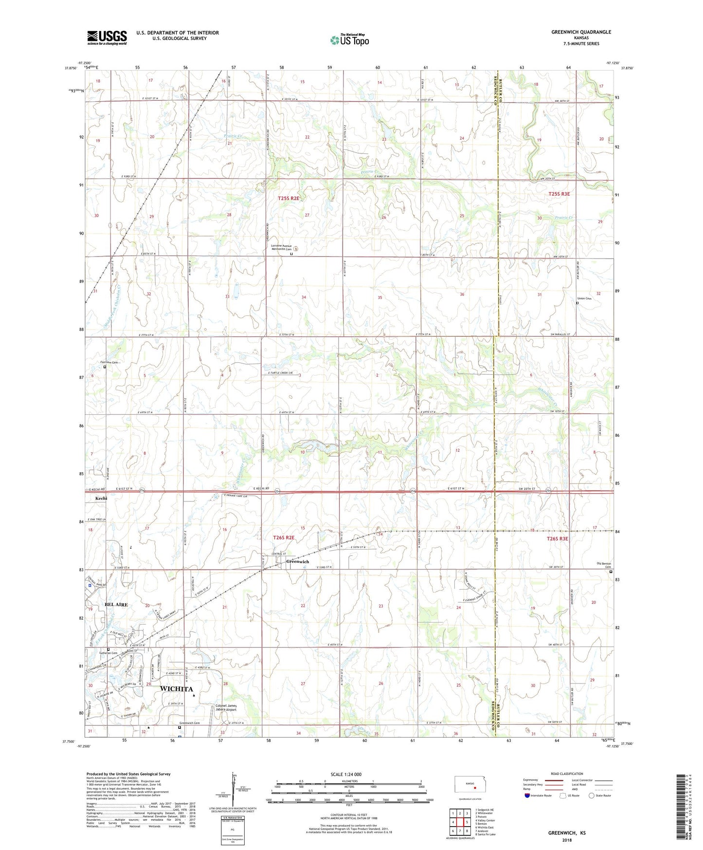
Greenwich Kansas US Topo Map
Couldn't load pickup availability
2022 topographic map quadrangle Greenwich in the state of Kansas. Scale: 1:24000. Based on the newly updated USGS 7.5' US Topo map series, this map is in the following counties: Sedgwick, Butler. The map contains contour data, water features, and other items you are used to seeing on USGS maps, but also has updated roads and other features. This is the next generation of topographic maps. Printed on high-quality waterproof paper with UV fade-resistant inks.
Quads adjacent to this one:
West: Valley Center
Northwest: Sedgwick NE
North: Whitewater
Northeast: Potwin
East: Benton
Southeast: Santa Fe Lake
South: Andover
Southwest: Wichita East
This map covers the same area as the classic USGS quad with code o37097g2.
Contains the following named places: 45 Rock Road Industrial Park, 67055, 67226, 67228, Bel Aire City Hall, Bel Aire Municipal Court, Bel Aire Police Department, Bel Aire Senior Center, City of Bel Aire, Clarion, Eck Airfield, Fairview Cemetery, Flying R N Airport, Greenwich, Greenwich Cemetery, Greenwich Census Designated Place, Kansas Heart Hospital, Lorraine Avenue Mennonite Cemetery, Lutheran Cemetery, Northeast Magnet High School, Old Benton Cemetery, Palmyra Baptist Church, Township of Lincoln, Township of Payne, Union Cemetery, Vatterott College - Wichita Campus, Wichita State University Technical, Willowbend Golf Club