MyTopo
Whitewater Kansas US Topo Map
Couldn't load pickup availability
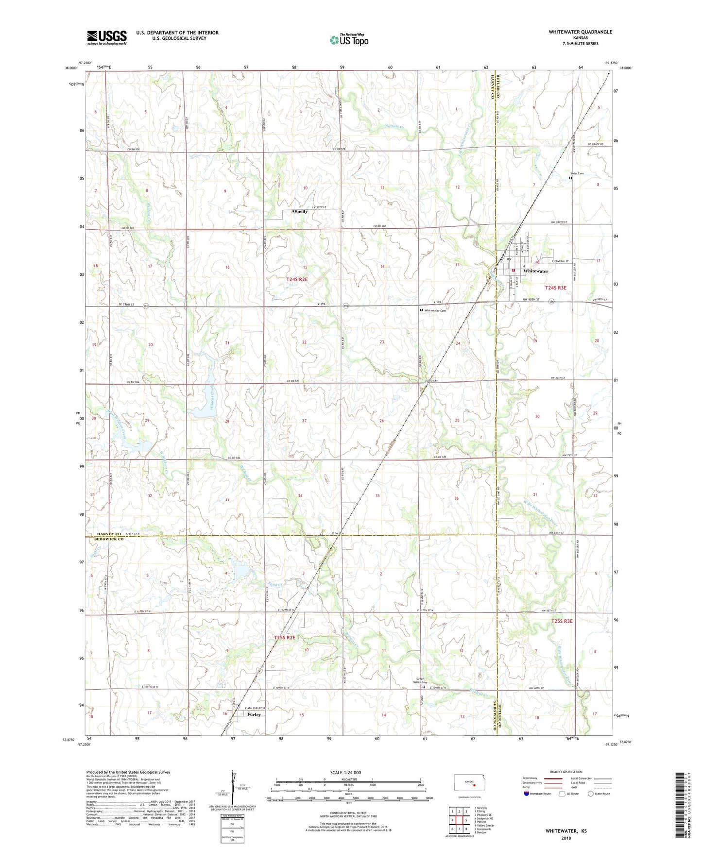
2022 topographic map quadrangle Whitewater in the state of Kansas. Scale: 1:24000. Based on the newly updated USGS 7.5' US Topo map series, this map is in the following counties: Harvey, Sedgwick, Butler. The map contains contour data, water features, and other items you are used to seeing on USGS maps, but also has updated roads and other features. This is the next generation of topographic maps. Printed on high-quality waterproof paper with UV fade-resistant inks.
Quads adjacent to this one:
West: Sedgwick NE
Northwest: Newton
North: Elbing
Northeast: Peabody SE
East: Potwin
Southeast: Benton
South: Greenwich
Southwest: Valley Center
This map covers the same area as the classic USGS quad with code o37097h2.
Contains the following named places: Annelly, City of Whitewater, Dubois Oil Field, East Branch Whitewater Creek, Edgcomb, Federated Church, Furley, Furley Census Designated Place, Furley Oil Field, Grace Baptist Church, Green Valley Cemetery, Gypsum Creek, Remington Middle School, Sand Creek, Swiss Cemetery, Swiss Church, Team Marketing Alliance Grain Elevator Number 37, Township of Richland, West Branch Whitewater Creek, West Wildcat Creek, Whitewater, Whitewater Cemetery, Whitewater City Hall, Whitewater Memorial Library, Whitewater Post Office, Whitewater River Consolidated Fire District - Whitewater Station, Whitewater Wastewater Plant, ZIP Code: 67154