MyTopo
Potwin Kansas US Topo Map
Couldn't load pickup availability
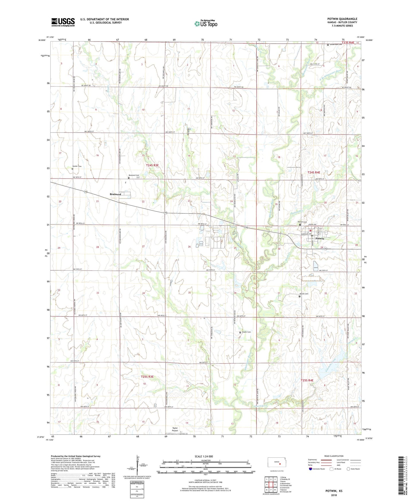
2022 topographic map quadrangle Potwin in the state of Kansas. Scale: 1:24000. Based on the newly updated USGS 7.5' US Topo map series, this map is in the following counties: Butler. The map contains contour data, water features, and other items you are used to seeing on USGS maps, but also has updated roads and other features. This is the next generation of topographic maps. Printed on high-quality waterproof paper with UV fade-resistant inks.
Quads adjacent to this one:
West: Whitewater
Northwest: Elbing
North: Peabody SE
Northeast: Burns
East: El Dorado NW
Southeast: El Dorado SW
South: Benton
Southwest: Greenwich
This map covers the same area as the classic USGS quad with code o37097h1.
Contains the following named places: 1917 Community House, Bethel Church, Brainerd, Brainerd Cemetery, Brush Creek, Cariboo, City of Potwin, Deer Creek, Diamond Creek, Dry Creek, East Branch Whitewater River, Emmaus Mennonite Church, First Christian Church, First United Methodist Church of Potwin, Fourmile Creek, Goldengate School, Haldeman Cemetery, Harder Cemetery, Henry Creek, McGill Cemetery, Potwin, Potwin - Butler County Fire Department, Potwin Cemetery, Potwin City Hall, Potwin Oil Field, Potwin Post Office, Potwin Public Library, Remington Elementary School, Remington High School, Shafer Cemetery, Swenson Creek, Township of Milton