MyTopo
Burlington Kansas US Topo Map
Couldn't load pickup availability
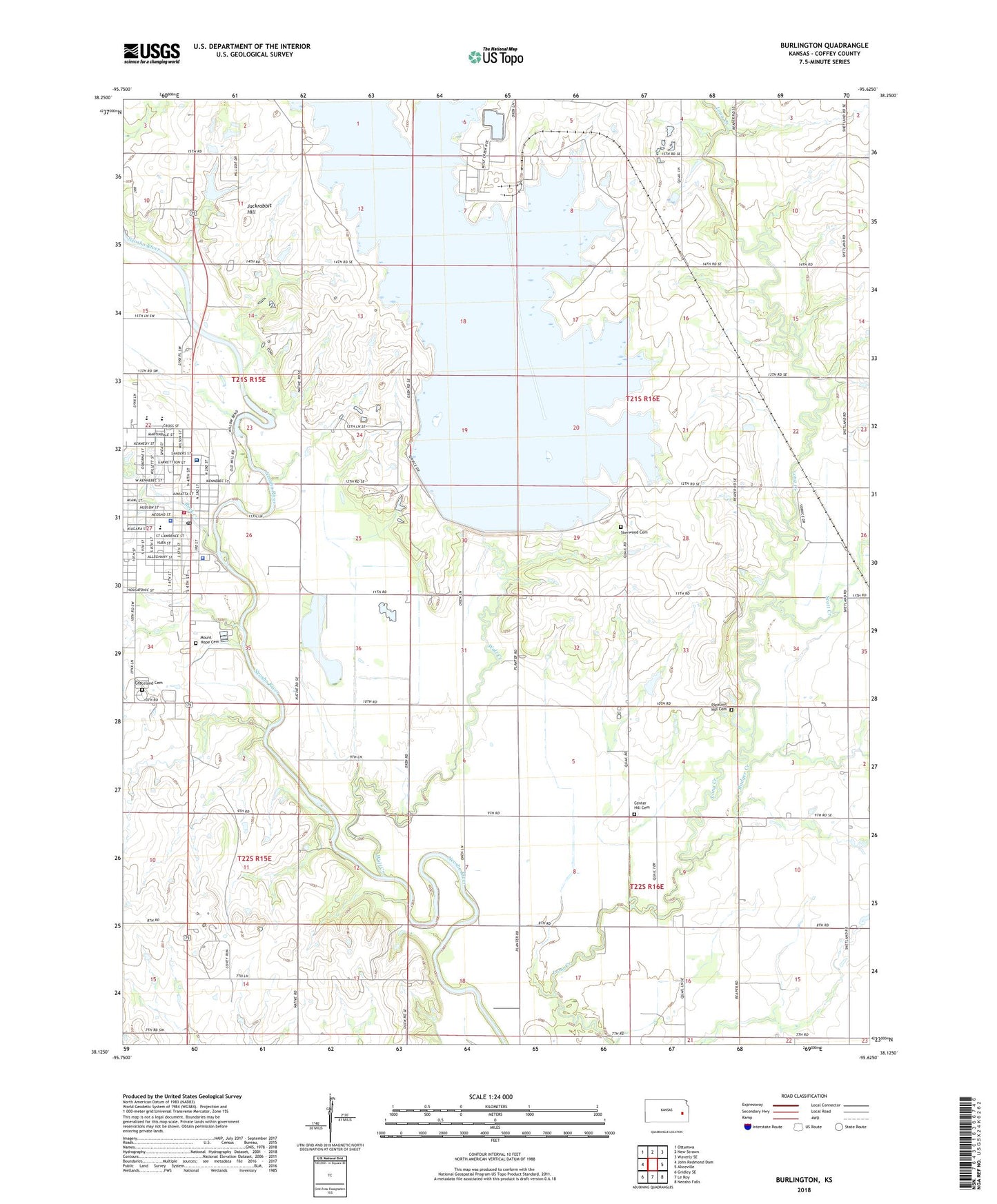
2022 topographic map quadrangle Burlington in the state of Kansas. Scale: 1:24000. Based on the newly updated USGS 7.5' US Topo map series, this map is in the following counties: Coffey. The map contains contour data, water features, and other items you are used to seeing on USGS maps, but also has updated roads and other features. This is the next generation of topographic maps. Printed on high-quality waterproof paper with UV fade-resistant inks.
Quads adjacent to this one:
West: John Redmond Dam
Northwest: Ottumwa
North: New Strawn
Northeast: Waverly SE
East: Aliceville
Southeast: Neosho Falls
South: Le Roy
Southwest: Gridley SE
This map covers the same area as the classic USGS quad with code o38095b6.
Contains the following named places: Badger Creek, Barrett Mobile Home Park, Botham Mobile Home Park, Burlington, Burlington Church of Christ, Burlington Church of the Nazarene, Burlington City Hall, Burlington Elementary School, Burlington High School, Burlington Middle School, Burlington Municipal Power Plant, Burlington Police Department, Burlington Post Office, Burlington Recreation Center, Burlington Senior Center, Burlington United Methodist Church, Burlington Wastewater Plant, Burlington Water Treatment Facility, Center Hill Cemetery, City of Burlington, Coffey County, Coffey County Chamber of Commerce, Coffey County Courthouse, Coffey County Emergency Medical Services, Coffey County Fire District 1 Burlington Station, Coffey County Health Department, Coffey County Historical Museum, Coffey County Hospital, Coffey County Jail, Coffey County Lake, Coffey County Library Burlington Branch, Coffey County Sheriff's Office, First Assembly of God Church, First Baptist Church, Graceland Cemetery, Hampden, Jackrabbit Hill, Kelley Park Rodeo Arena, Lighthouse Fellowship Church, Mathias Lake, Mount Hope Cemetery, Pleasant Hill Cemetery, Rock Creek, Saint Francis Xavier Catholic Church, Scott Creek, Sherwood Cemetery, Township of Hampden, Trinity Lutheran Church, Wolf Creek, Wolf Creek Airport, Wolf Creek Generating Station, ZIP Code: 66839