MyTopo
New Strawn Kansas US Topo Map
Couldn't load pickup availability
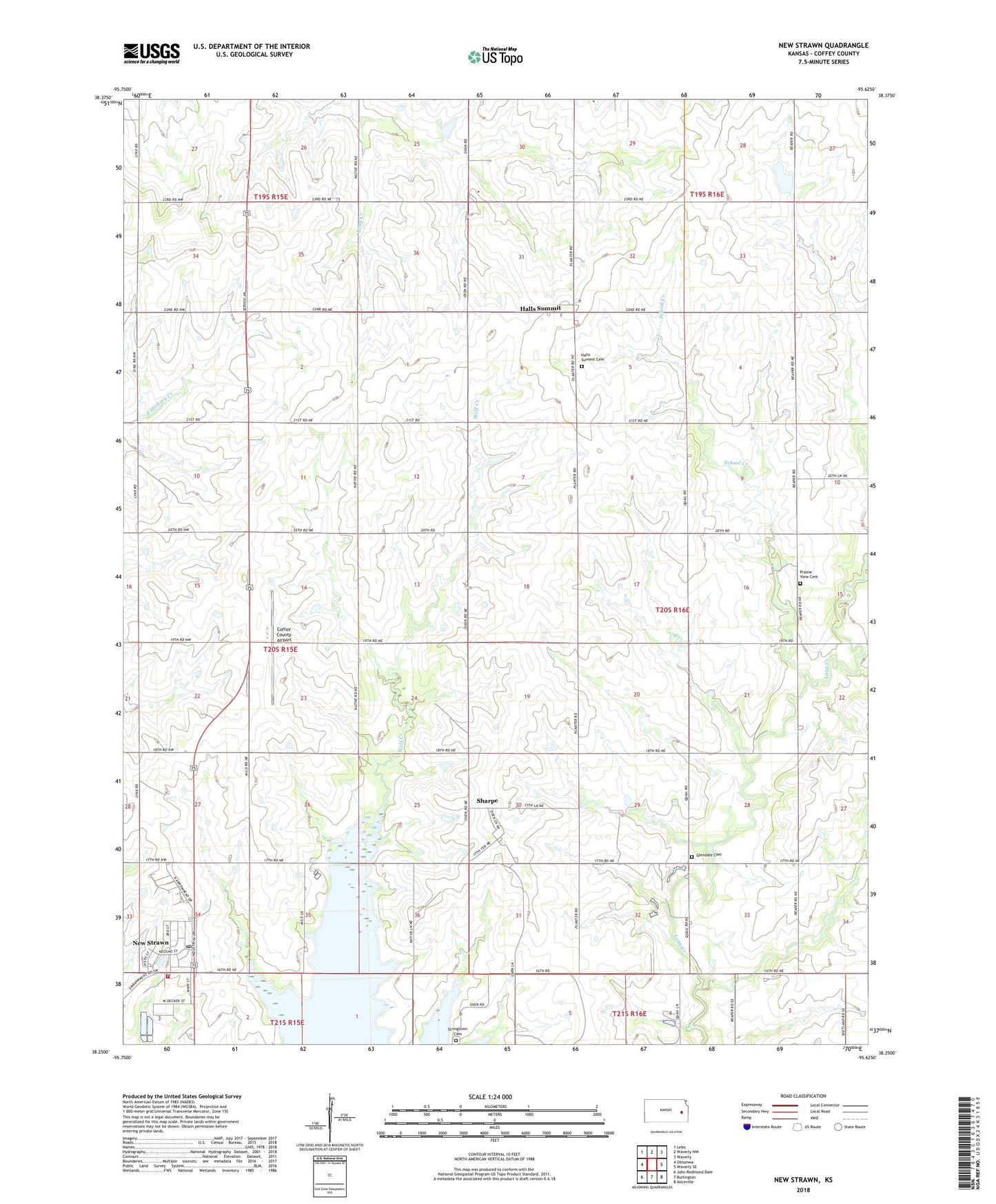
2022 topographic map quadrangle New Strawn in the state of Kansas. Scale: 1:24000. Based on the newly updated USGS 7.5' US Topo map series, this map is in the following counties: Coffey. The map contains contour data, water features, and other items you are used to seeing on USGS maps, but also has updated roads and other features. This is the next generation of topographic maps. Printed on high-quality waterproof paper with UV fade-resistant inks.
Quads adjacent to this one:
West: Ottumwa
Northwest: Lebo
North: Waverly NW
Northeast: Waverly
East: Waverly SE
Southeast: Aliceville
South: Burlington
Southwest: John Redmond Dam
This map covers the same area as the classic USGS quad with code o38095c6.
Contains the following named places: City of New Strawn, Coffey County Airport, Coffey County Fire District 1 Station 8, Coffey County Library New Strawn Branch, Glendale Cemetery, Halls Summit, Halls Summit Cemetery, Indian Plains Golf Course, New Strawn, New Strawn City Hall, New Strawn Community Center, New Strawn Post Office, New Strawn Wastewater Plant, Oread, Pottawatomie, Prairie View Cemetery, Prairie View United Methodist Church, School Creek, Sharpe, Township of Ottumwa, Wolf Creek Cemetery