MyTopo
Burrton Kansas US Topo Map
Couldn't load pickup availability
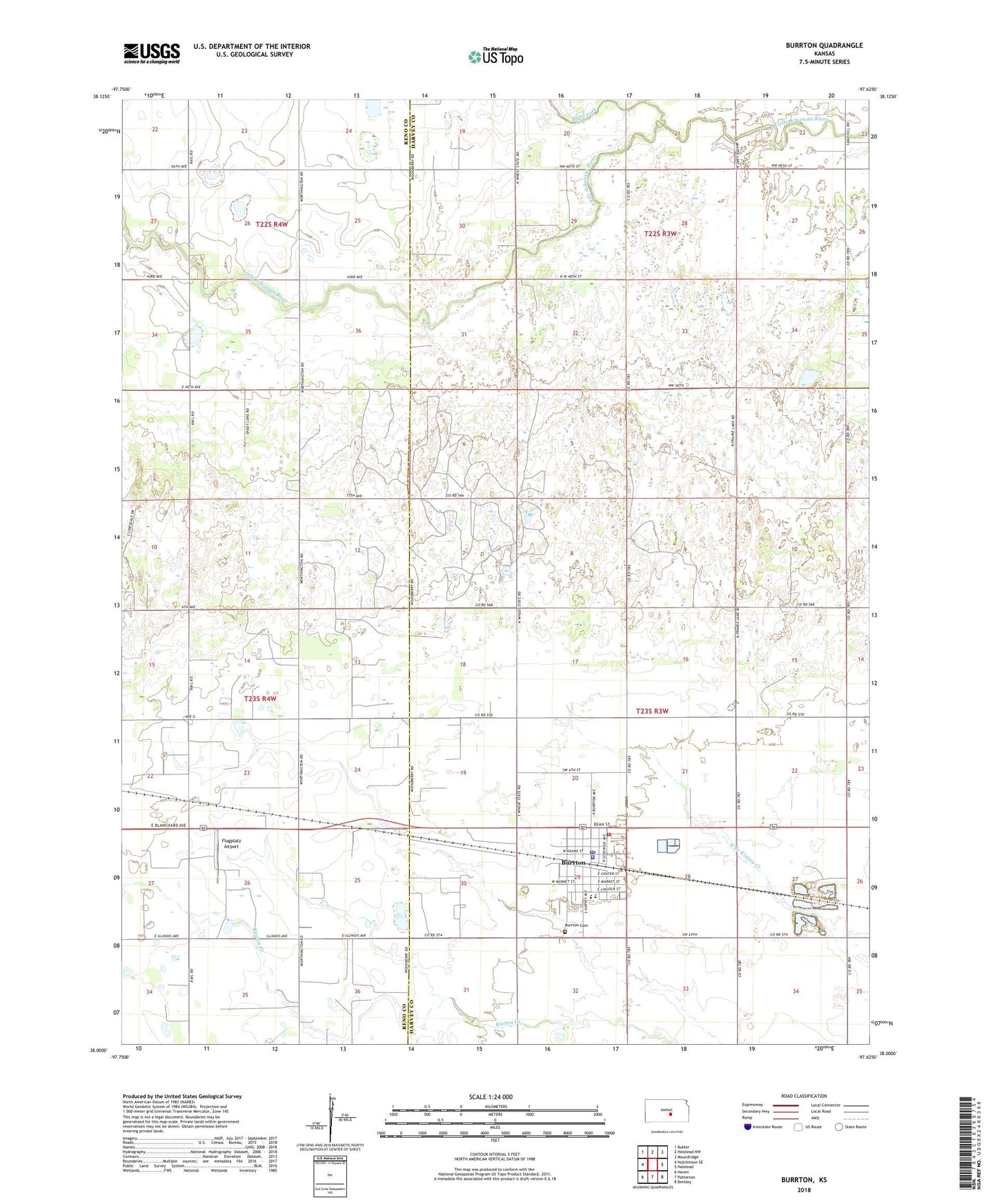
2022 topographic map quadrangle Burrton in the state of Kansas. Scale: 1:24000. Based on the newly updated USGS 7.5' US Topo map series, this map is in the following counties: Harvey, Reno. The map contains contour data, water features, and other items you are used to seeing on USGS maps, but also has updated roads and other features. This is the next generation of topographic maps. Printed on high-quality waterproof paper with UV fade-resistant inks.
Quads adjacent to this one:
West: Hutchinson SE
Northwest: Buhler
North: Halstead NW
Northeast: Moundridge
East: Halstead
Southeast: Bentley
South: Patterson
Southwest: Haven
This map covers the same area as the classic USGS quad with code o38097a6.
Contains the following named places: Blaze Fork, Burrton, Burrton Ambulance Department, Burrton Cemetery, Burrton City Hall, Burrton Elementary School, Burrton Gas Field, Burrton Mennonite Church, Burrton Middle / High School, Burrton Police Department, Burrton Post Office, Burrton Senior Center, Burrton Sewer Treatment Plant, Burrton United Methodist Church, City of Burrton, Fairview Elementary School, Faith Community Bible Church, First Christian Church, Flugplatz Airport, Harvey Fire District 5, Lily Dale School, Township of Burrton, Township of Little River, Willis School, ZIP Codes: 67020, 67522