MyTopo
Moundridge Kansas US Topo Map
Couldn't load pickup availability
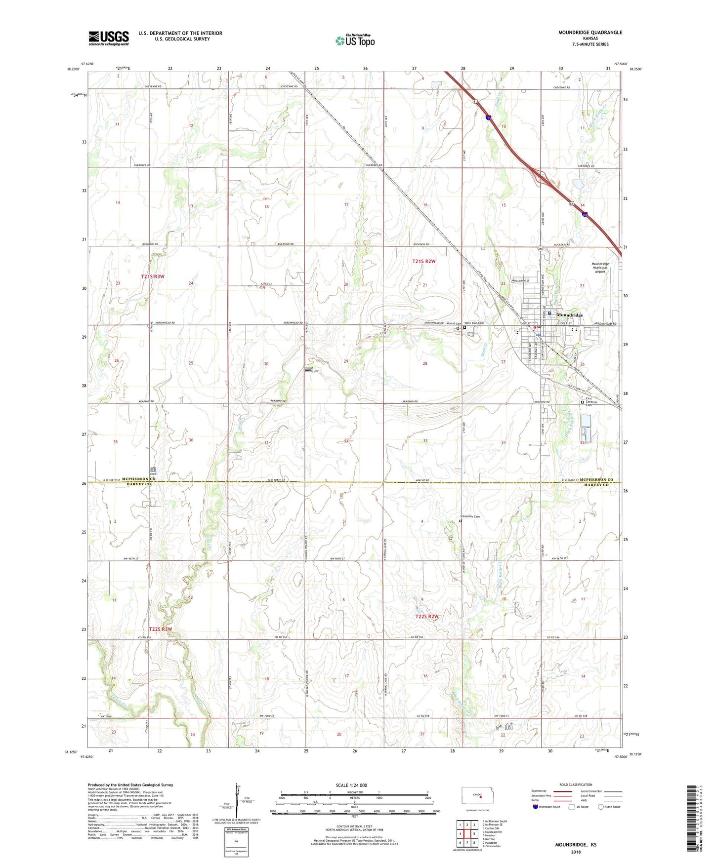
2022 topographic map quadrangle Moundridge in the state of Kansas. Scale: 1:24000. Based on the newly updated USGS 7.5' US Topo map series, this map is in the following counties: McPherson, Harvey. The map contains contour data, water features, and other items you are used to seeing on USGS maps, but also has updated roads and other features. This is the next generation of topographic maps. Printed on high-quality waterproof paper with UV fade-resistant inks.
Quads adjacent to this one:
West: Halstead NW
Northwest: McPherson South
North: McPherson SE
Northeast: Canton SW
East: Hesston
Southeast: Zimmerdale
South: Halstead
Southwest: Burrton
This map covers the same area as the classic USGS quad with code o38097b5.
Contains the following named places: City of Moundridge, Cloverleaf School, Eden Mennonite Church, First Mennonite Cemetery, First Mennonite Church, Gospel Mennonite Church, Harmac Oil Field, Hopefield Mennonite Church, Lake View, Liberty School, McPherson County Rural Fire District 7 Moundridge, Memorial Home, Mercy Hospital, Mound Cemetery, Moundridge, Moundridge City Hall, Moundridge Elementary School, Moundridge Emergency Medical Services, Moundridge Evangelical Free Church, Moundridge High School, Moundridge Middle School, Moundridge Municipal Airport, Moundridge Police Department, Moundridge Post Office, Moundridge Public Library, Moundridge Senior Citizens Center, Moundridge Sewer Treatment Plant, Moundridge United Methodist Church, Saint John's Lutheran Church, Schlender Cemetery, Sperling Oil Field, Team Marketing Alliance Grain Elevator Number 1, Township of Garden, Township of Mound, West Zion Cemetery, West Zion Mennonite Church, ZIP Code: 67107